Rubber Chicken
Aug 14, 2013
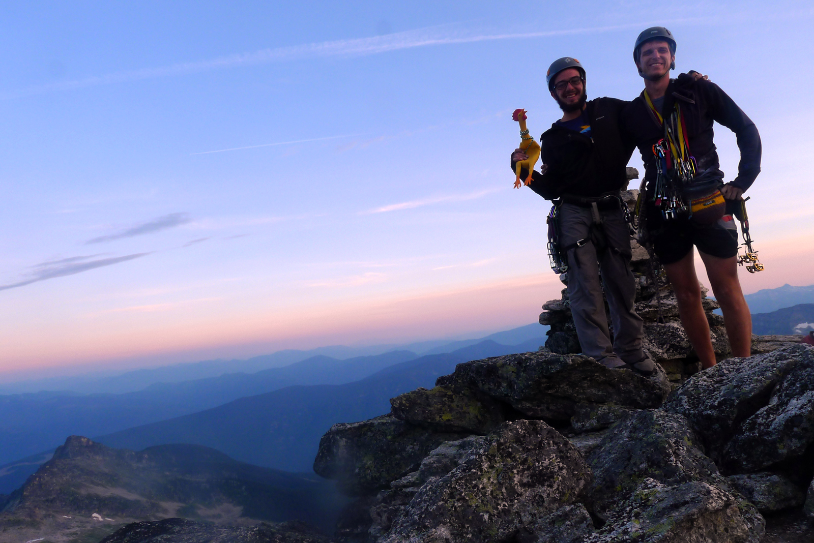 Last weekend, Hank, his climbing buddy Pat, and their other climbing buddy, the orange-footed yaller guy, summited Mount Gimli, a 9,000-foot spire of gneiss in the Valhalla Range of southeastern British Columbia.
Aug 14, 2013
Last weekend, Hank, his climbing buddy Pat, and their other climbing buddy, the orange-footed yaller guy, summited Mount Gimli, a 9,000-foot spire of gneiss in the Valhalla Range of southeastern British Columbia.
Sep 2, 2013
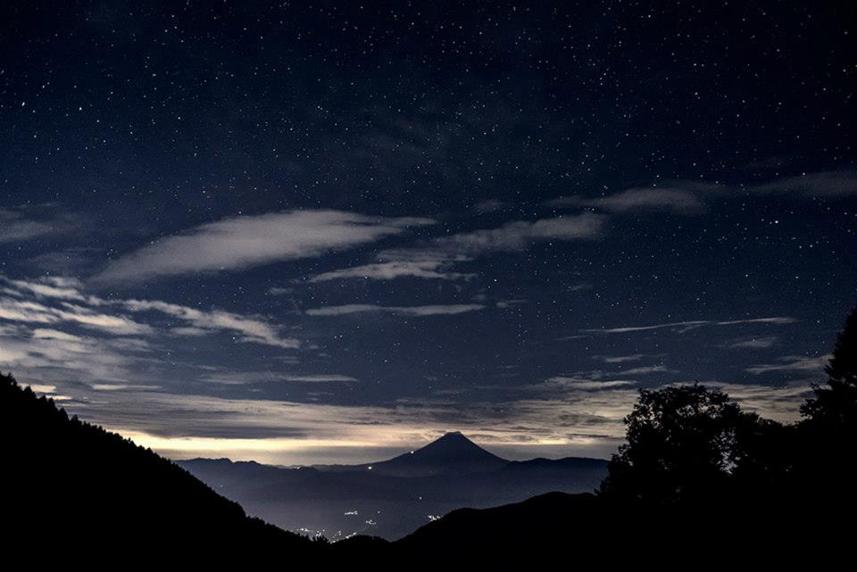 Japan's Mount Fuji, just before dawn.
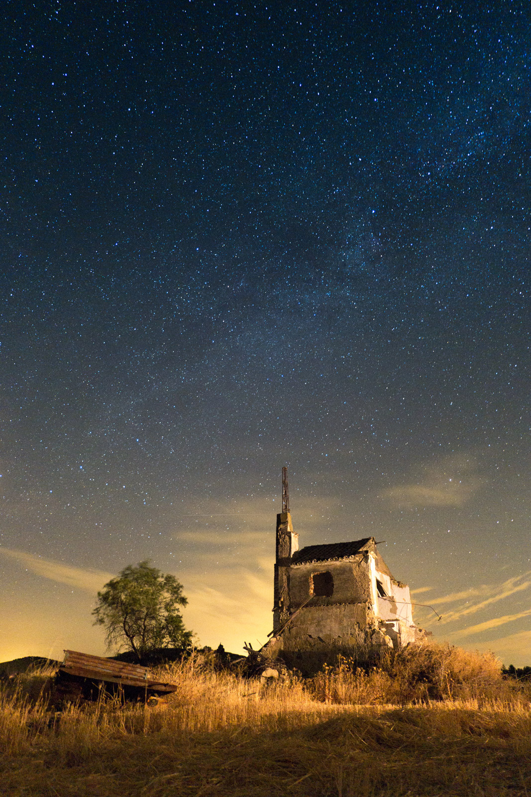
This is a pretty spectacular photo, with the features of an iconic landscape dwarfed by a skyful of stars and clouds and hints of daylight. Modern cameras can capture this sort of scene more or less routinely if they are set up to stare into the night, lens wide open, without blinking or moving for, in this case, twenty seconds.
The human eye could drink it in at a glance, if only we were there. But we weren't there, sadly. This morning, we must make do with the picture, and fortunately it's a picture that rewards a slowly wandering eye with pleasant little discoveries in the realms of shadow and glow, detail and hulk, pattern and emptiness.
Sep 11, 2013
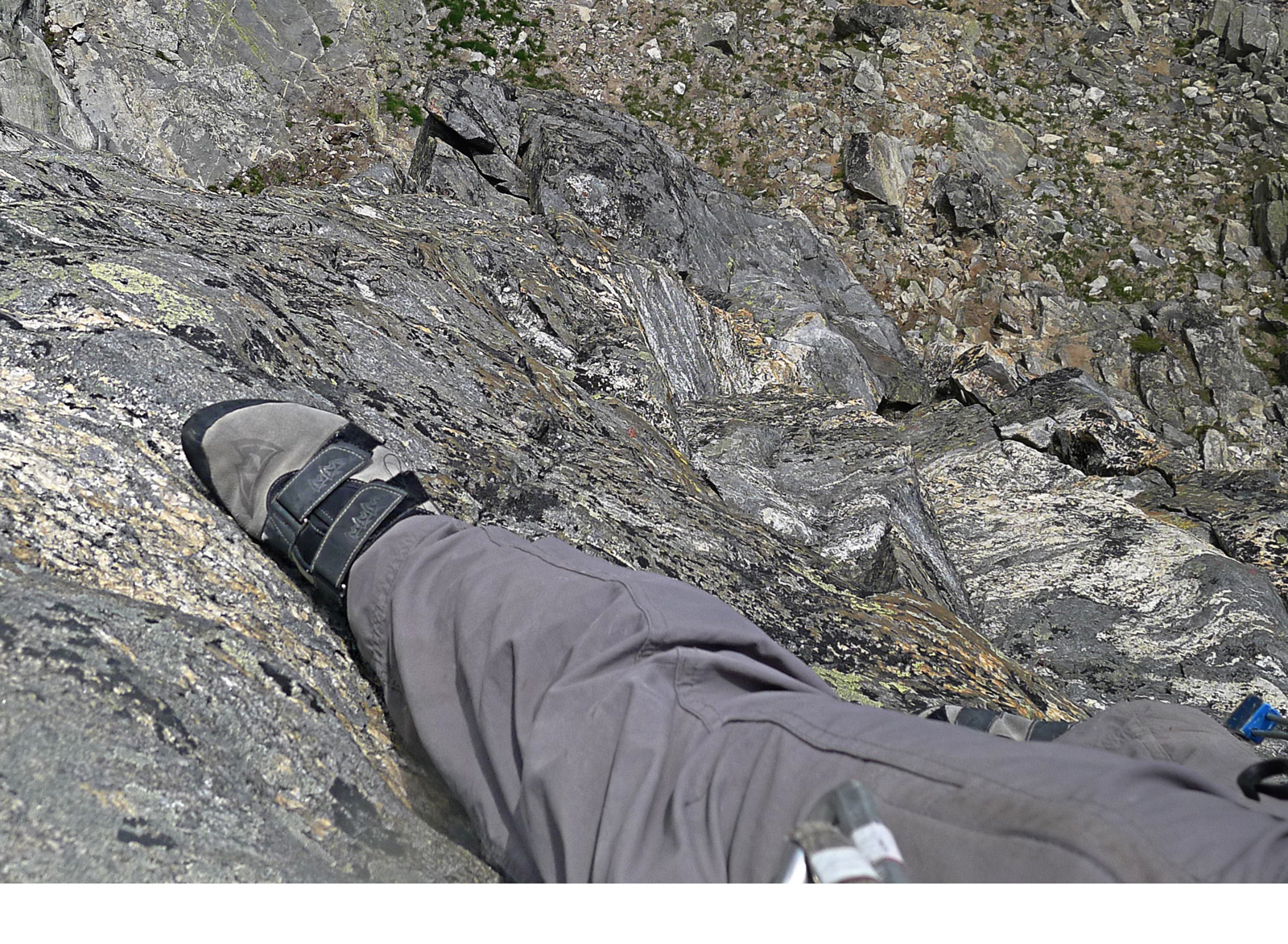 The climb must have been going pretty well, straight up the wall of Mt. Gimli, in Canada's Kootenay Rockies. And then Hank stopped for a moment and looked down.
We might speculate that looking down would be a terrible thing to do. But all the evidence suggests that Hank just calmly snapped a picture of his own right foot and then went back to climbing on up.
He and Pat, his climbing partner, summited, rappelled down, hiked back out to their car, and drove into town to find something to eat.
For the record: They wore their helmets and harnesses and utilized their ropes and stuff. No mammals were injured in the making of this photograph.
Oct 10, 2013
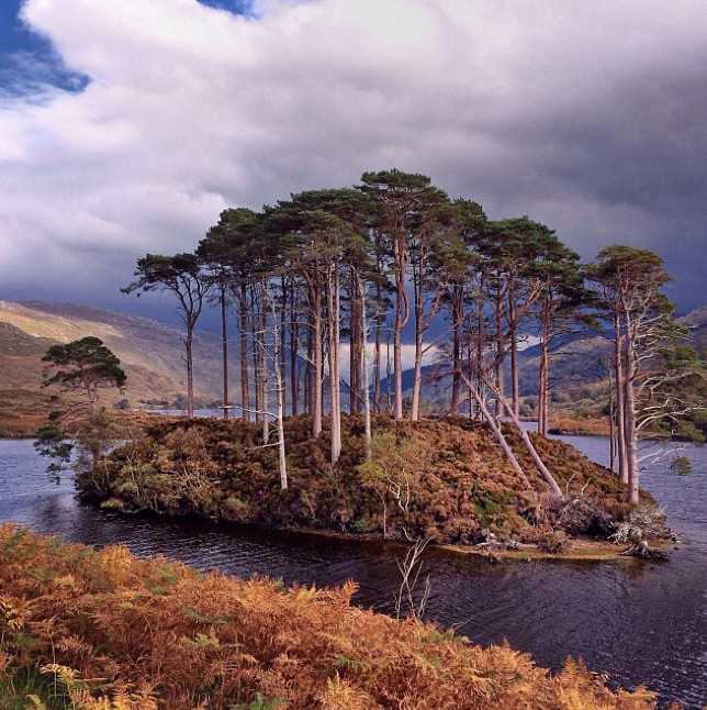
Apple hired National Geographic photographer Jim Richardson to go up into the Scottish highlands and shoot some scenery with an iphone camera.
Oct 15, 2013
 Moscow in the background.
Nov 9, 2013
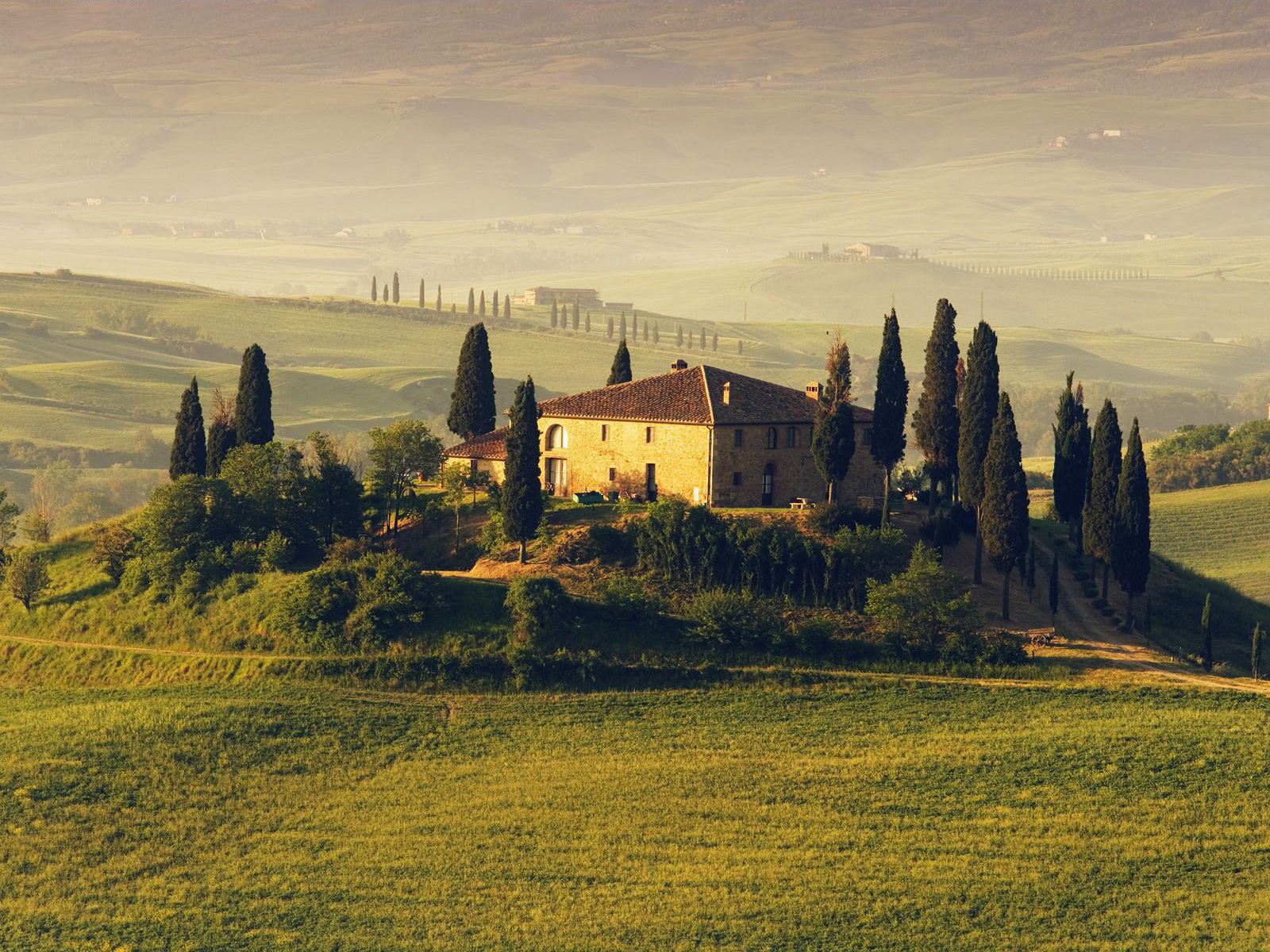 Villa at sunrise, San Quirico d'Orcia.
Nov 14, 2013
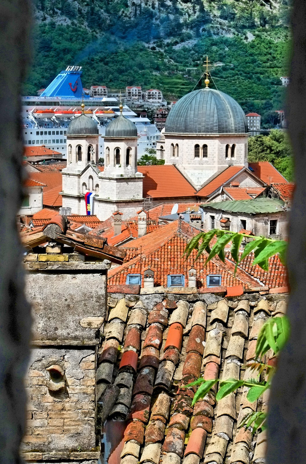 The Montenegran town of Kotor, as viewed through an opening in its Byzantine-era fortifications. Behind the domes are smokestacks of one of the umpteen dozen cruise ships that visit Kotor nowadays while steaming along the Dalmatian coast.
Nov 17, 2013
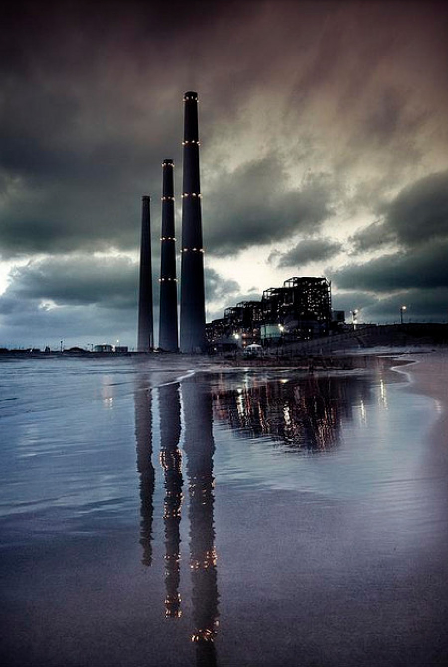 Smokestacks of Israel's largest power plant, Orot Rabin, loom over the beach at Hadera, north of Tel Aviv. The plant's coal-fired turbines produce almost one-quarter of Israel's electricity.
The low structures leading from the chimneys to the left edge of the picture are part of the power station's coal port offshore in the Mediterranean, where ships offload 18,000 tons of coal every day.
The plant is called Orot Rabin–Rabin Lights–in remembrance of Israeli President Yitzhak Rabin, who was assassinated in 1995. Electricity generated here lights much of the country, producing something like the memorial lights of Jewish tradition, helping to keep alive the memory of those who are gone.
Nov 19, 2013
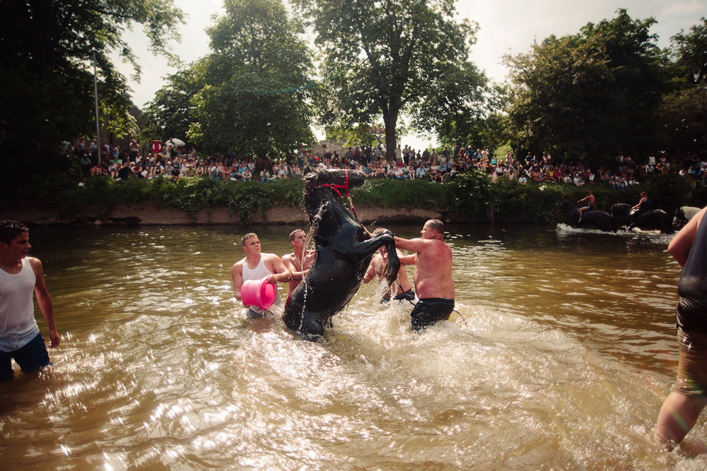 Horses are washed in the Eden River before being paraded through town for the Appleby Horse Fair last June.
The annual fair is Europe's largest gathering of gypsies and travellers. It is also one of the oldest fairs in England, occurring every June since 1685, when King James II granted a royal charter permitting a horse fair "near to the River Eden" in Cumbria; an estimated 10,000 English and Welsh gypsies, Irish travellers, and Scottish gypsy/travellers assemble for the fair to buy and sell horses and catch up with friends and relatives.
In recent years, the gypsies are joined by about 30,000 non-travellers (muggles?) who travel to Appleby to see the gypsies and their horses.
"Appleby Horse Fair is not an organised event," warns a local government publication aimed at potential tourists. "There is no set programme for anything happening. The horses are washed and trotted up and down the flashing lane.
"There is a market on Jimmy Winter's field selling a variety of goods–some traditional to the gypsy/travelling community–and other. To arrange to sell on that field, please contact Jimmy Winter....
"There is no horse auction. Sale arrangements are made buyer to seller for cash. The price will usually include extra for Luck Money."
Tourists are also warned that accommodations in the vicinity during fair week will be "rarer than hen's teeth. If you have a tent, however, you may be able to camp at Holme Farm Field. Speak to Mrs. Bousfield."
Nov 25, 2013
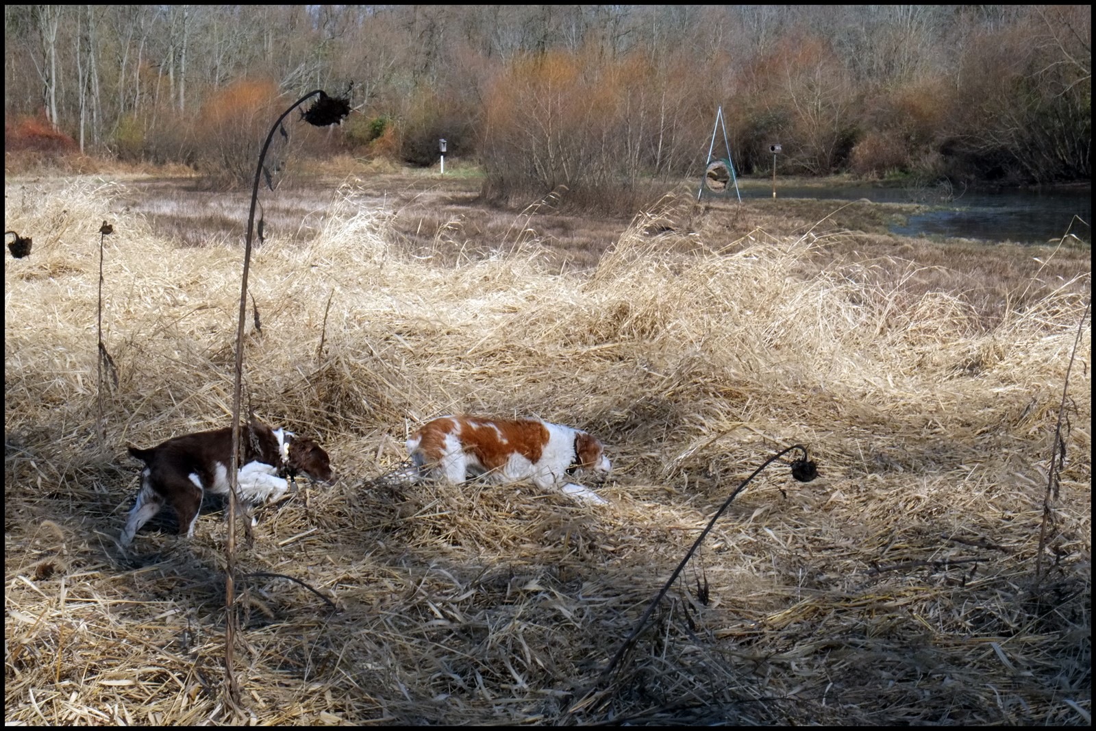 Both of these Brittany Spaniels–bird dogs, for certain sure–believe they're onto something, here in a Pennsylvania marsh where just a few short months ago, sunflowers were smiling.
Nov 27, 2013
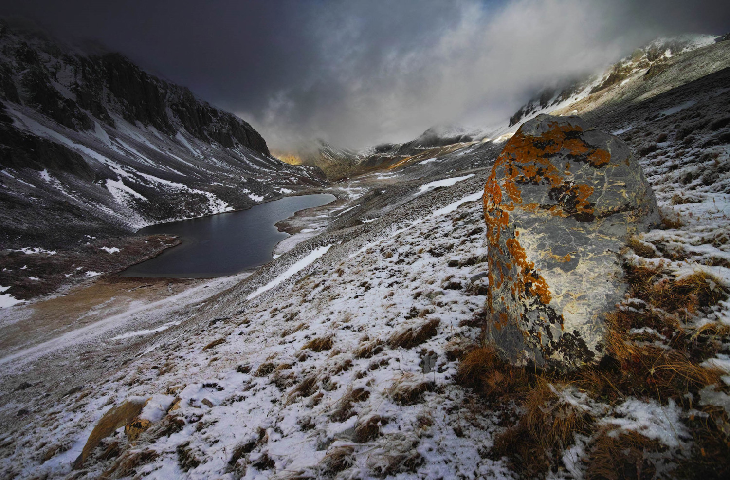 The cold and the storms both showed up in Philadelphia this week, but somehow the effect we see here in a high mountain valley in the Tyrolean Alps is a little more dramatic and astonishing than it is out on the streets and sidewalks of Brotherly Love. Pretty much all we've got in town right now are slashing rains and chill.
Feb 18, 2014
 As today's contribution to the occasional series "Places We've Not Been and Have No Business Trying to Write Anything About," please consider this roofscape scene taken in Lijiang village, a UNESCO World Heritage site high in the hills of southwest China, near the border with Myanmar.
Human habitation in Lijiang has been continuous since before there was such a thing as a roofscape, or even a roof; paleolithic cave-dwellers were here. The ancient Silk Road passed through here. Townspeople grew wealthy through trade and tribute, and they began to rebuild their town in more elaborate, decorative styles.
Civilization was flourishing here in the thirteenth century. And fortunately for some, within about eight hundred years, give or take, the tourists showed up.
Mar 14, 2014
 This year in Philadelphia, spring is coming ridiculously late, but it's coming. One sign that gives us high confidence in spring's imminence involves the tips of the crocus stalks, which are just now beginning to poke their way up out of the cold, wet ground. They'll be blooming soon, maybe within the week.
In the high meadows of Bulgaria's Rila Mountains, tallest peaks in the Balkan Peninsula (2925 m), spring always comes late, and crocuses don't bloom till the middle of June. This picture was taken two springs ago on June 19, 2012.
To catch the bright red glow on the ridge rocks, photographer Evgeni Dinev had to climb up here the day before, hauling up a tent, tripod, and all his camera gear. He snapped the shot at sunrise.
Mar 28, 2014
 The Dreamlifter, world's largest cargo plane, stops off regularly in Anchorage, Alaska, en route from parts suppliers in Japan to a Boeing aircraft assembly plant in Everett, Washington.
Some of the parts that travel by Dreamlifter are large modular sections of Boeing 787 jetliners, known as Dreamliners. The sub-assemblies, much too large for other cargo planes, used to be transported by ship, which could take thirty days or more and sometimes led to delays in final assembly.
In 2005, four 747 passenger planes were remodeled to fly as cargo planes carrying the sub-assemblies, which are loaded through a wide hatch at the stern. Other cargo planes can carry more weight, but none can match the four puffed-up Dreamlifters for sheer volume of storage space.
Apr 21, 2014
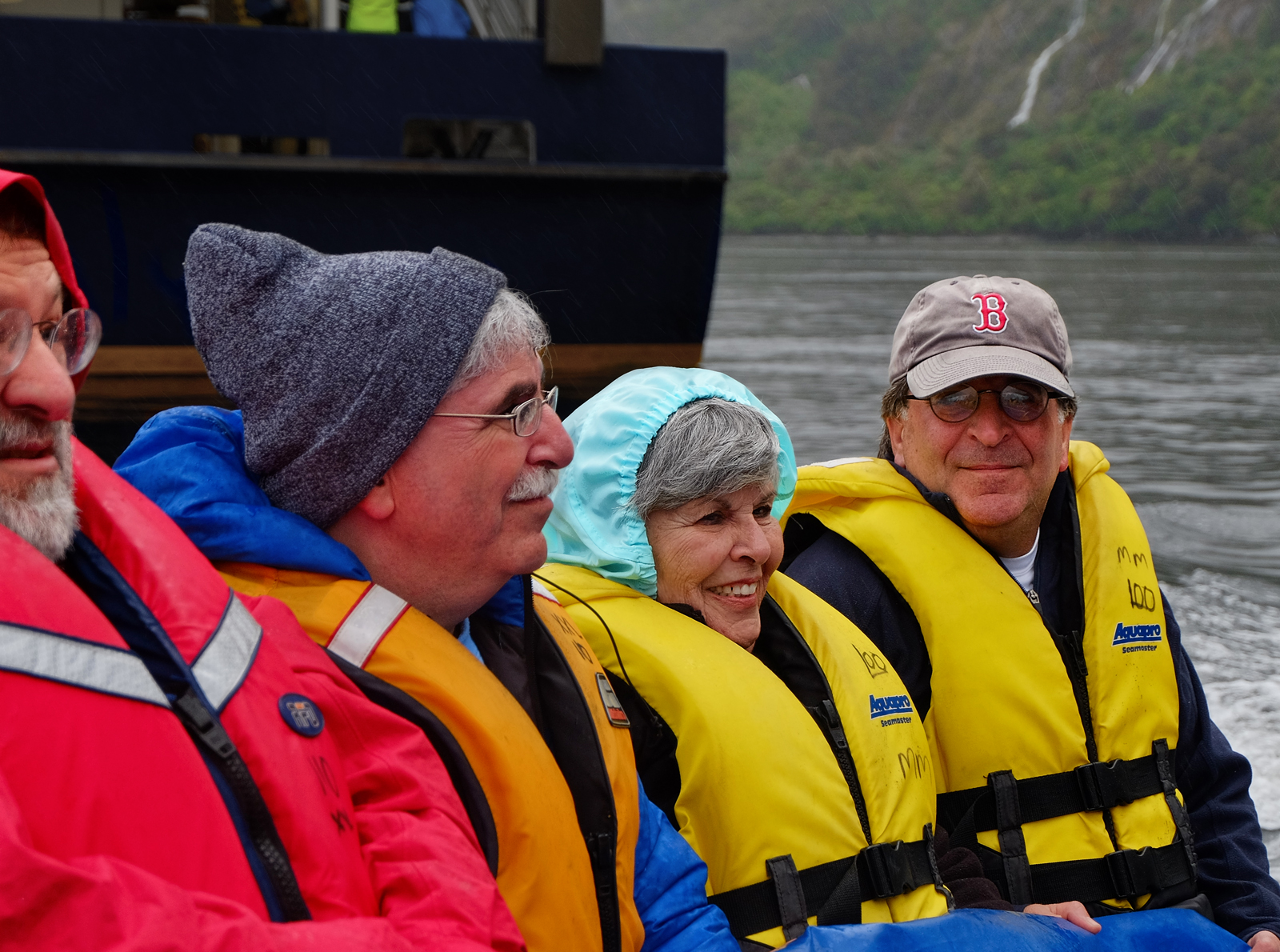 Here in a Zodiac, scooting across Milford Sound, a fjord on New Zealand's remote southwest coast, on a cold wet summer day this past December, is Helen Ruskin Stein Behr with her three sons. Not pictured is her daughter, who visited Milford Sound a few days earlier.
The impetus for the journey to New Zealand was the awesome wedding of one of the granddaughters, Gillian, who emigrated to New Zealand seven years ago with her parents, Richard and Arleigh, and her sister Avi.
Today is Helen's birthday, as she turns eighty-something-and-who's-counting, to our great joy. Wishing her many happy returns of the day.
Apr 23, 2014
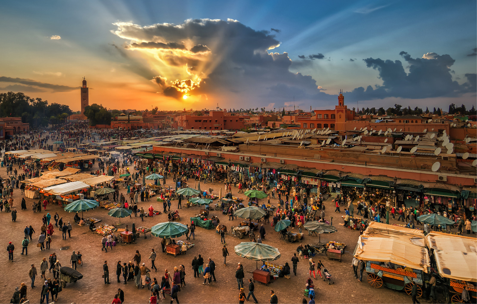 Up the road a ways past Casablanca in Morocco is the ancient Berber city of Marrakech, famed for its gardens and palaces and especially for its sprawling, labyrinthine markets.
Click on the picture to, um, biggenize it, to glimpse what's on display in this souk and also, perhaps, to check the accuracy of our unofficial count: mounted on rooftops visible here are at least 104 satellite dishes.
May 26, 2014
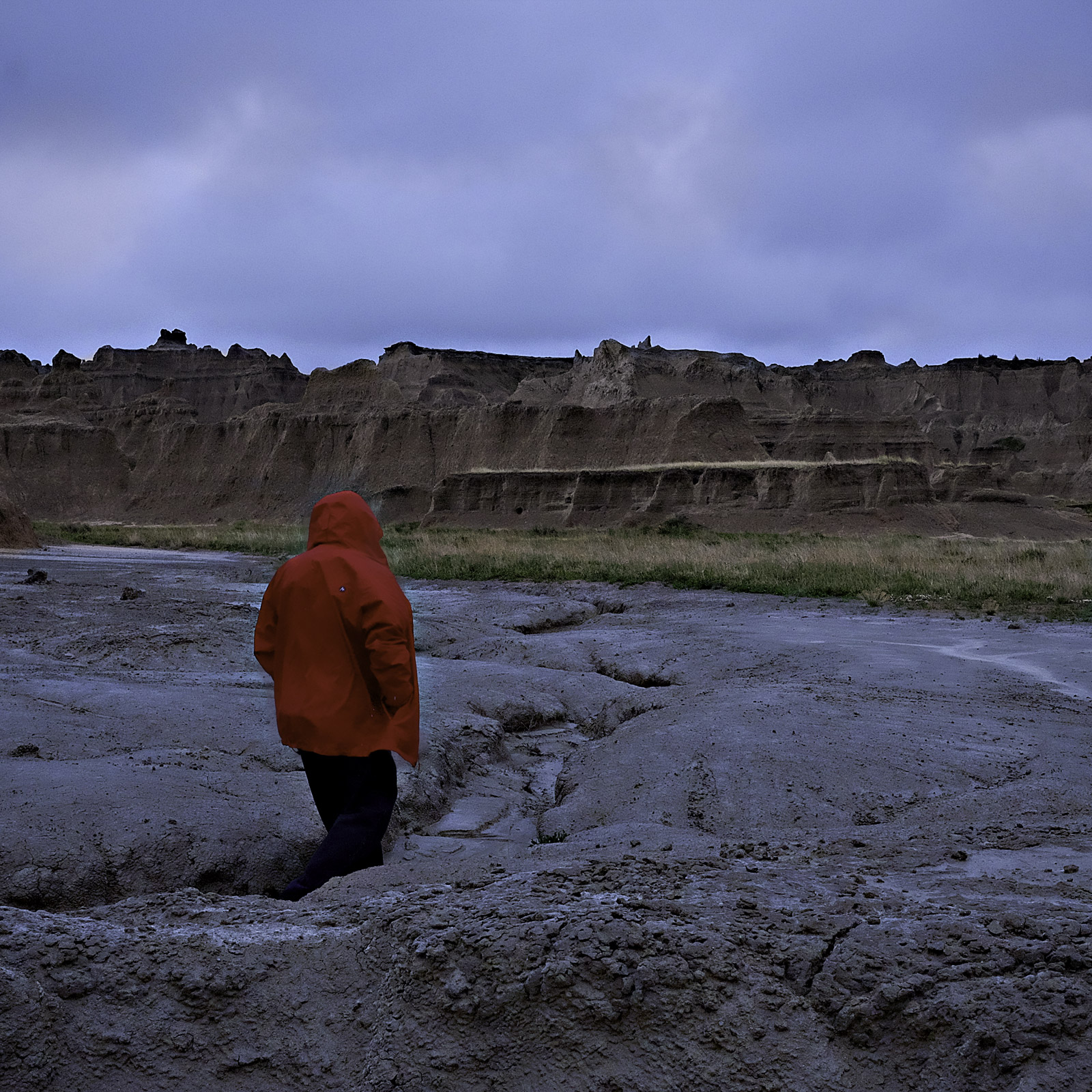 All it took was a few days of bad weather like this, every year for maybe half a million years, and most of the sediment that used to blanket this part of South Dakota has washed on down the White River and then into the Missouri and the Mississippi and the Gulf of Mexico.
This was an ancient seabed, back in the day, deeply mucky, collecting sand and silt and mud from the Black Hills nearby and the Rockies beyond. The sediments piled up in layers hundreds of feet thick, but when the ancient sea drained and the lithified muck was exposed to the elements, wind and rain and frost proved to be powerful chisels.
It's believed that in another half million years, the remaining spires and parapets will have crumbled down into the gullies, and it'll be curtains for the scenery hereabouts.
May 31, 2014
Jun 4, 2014
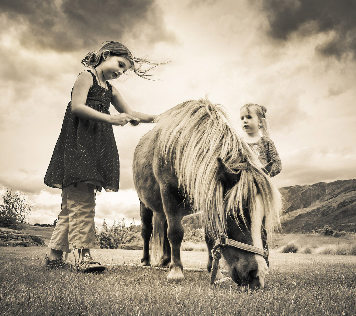 Girls grooming a very small horse in Gibbston, New Zealand.
Jun 10, 2014
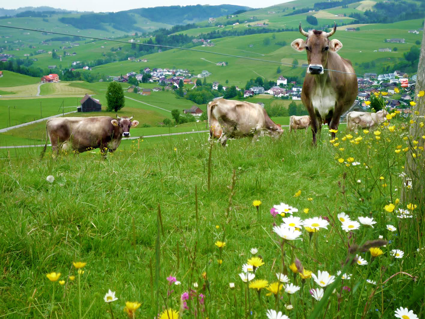 There are places in Switzerland that lack the scenic drama of Alpine crags and cliffs. Still and all, Switzerland is Switzerland, what with the daisies and the rolling meadows and the happy, happy cows. The postcard is complete. There's probably chocolate in those villages off in the distance.
Jul 27, 2014
Jul 28, 2014
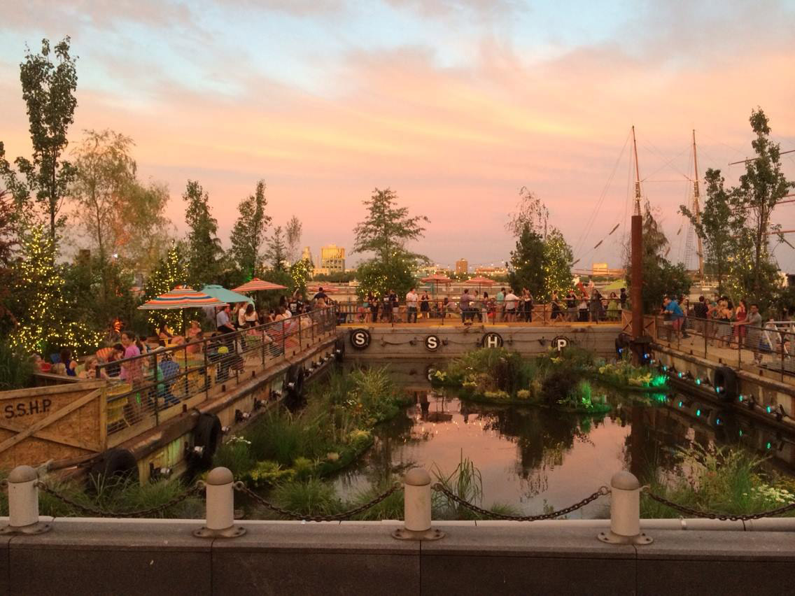 Spruce Street Harbor Park, at the foot of Spruce Street on the Delaware River, is Philly's latest pop-up beer garden. A couple of months ago, this was an unused dock behind the highway; a couple of months from now, it will probably return to nothingness. But for the summer of 2014, thanks to landscaping and logistics from the Pennsylvania Horticultural Society, it's drawing crowds.
It's also drawn a lawsuit, from folks who would rather the crowds spend their money in established bars and restaurants. Plaintiffs claim that the "special event" loophole in the city's liquor laws was never intended to legalize semi-long-term operations like the Horticultural Society's beer gardens.
The idea behind the pop-up gardens was booster-ish. By demonstrating the potential of vacant lots around town, it was hoped that developers might invest in permanent improvements. Meanwhile, people could enjoy themselves under the stars.
But with the lawsuit looming, somehow, it just seems like we can't have nice things any more.
Sep 10, 2014
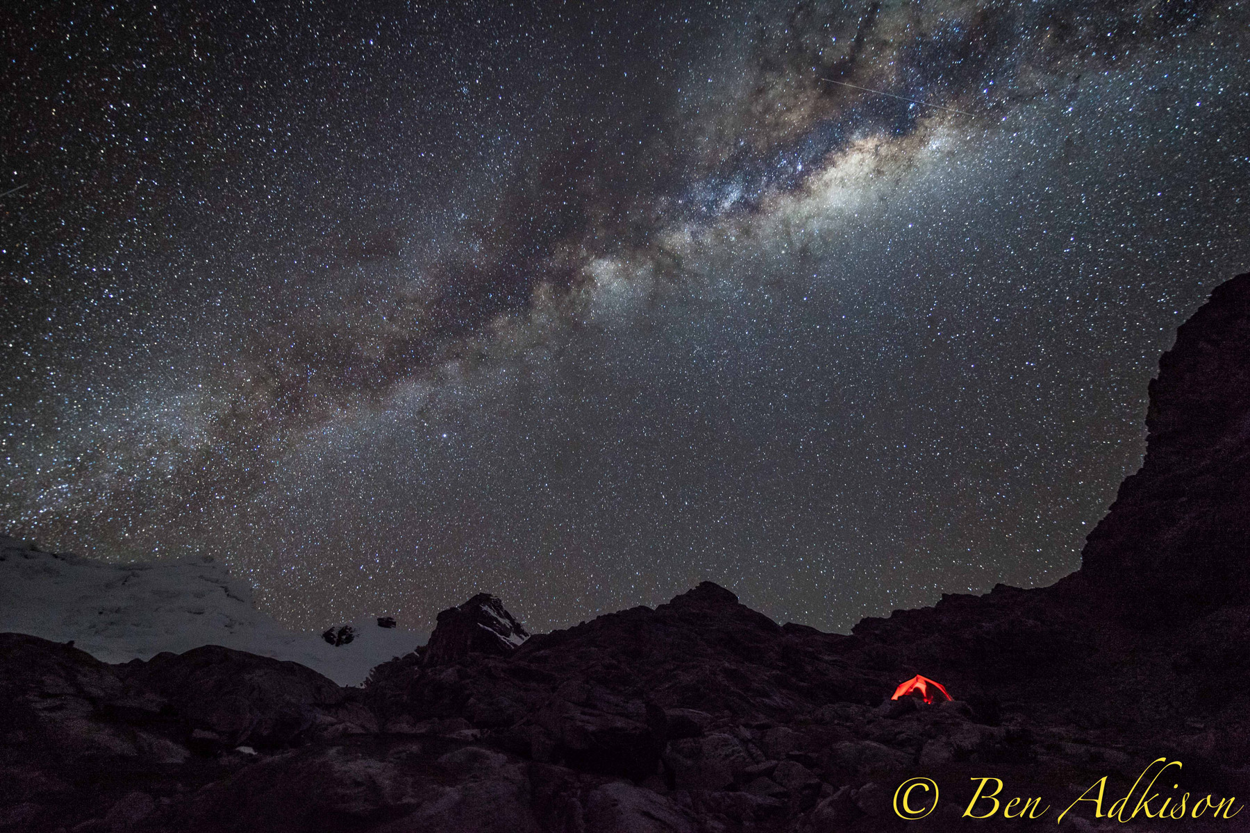 Last month, Hank joined a group of Montanans climbing in the Andes, summiting above 18,000 feet in the middle of the Peruvian winter. They were closer to the Milky Way up there.
Nov 8, 2014
Our last look at Iceland's ongoing volcanism touched on matters of earthquakes, a collapsing caldera, magma, lava, and tectonic rifting. But we failed to discuss the issue that has come to preoccupy Icelanders in recent months: poison gas, which spreads across the island as a blue haze, threatening the health of people, livestock, crops, and vegetation.
The gas belches out of the lava as sulfur dioxide, SO2, which is the odor we sniff in minute amounts when we strike a match. Around the site of the eruption, in barren terrain near central Iceland's Bardarbunga volcanic complex, the sulfur dioxide is so intensely concentrated that a single breath could be fatal. Fortunately, no one lives nearby; researchers approaching the volcanic vent wear elaborate gas masks and stay in the vicinity for only a few minutes at a time.
In addition to being dangerously sulfurous, the air near the eruption is also extremely turbulent. Steam from the vent and heat gusts from the surface of the lava lift and disperse the SO2 quite quickly. Early in the eruption, huge pulses of steam pushed the gas so high into the atmosphere that it was entrained in the jet stream and carried in low but measureable concentrations across the sea to northern and western Europe.
Within a few days, however, as the volcanic vent opened fully, the lava spilled out less forcefully. Sulfur dioxide was no longer blasted into the upper atmosphere; instead, it has settled as a smoggy blue haze, rolling along the surface of Iceland. The haze is steered by winds; an east wind blows it into Reykjavik, as seen above, while winds from other points of the compass blow it to every nook and cranny of the island.
When the haze is bad, Icelanders are told to stay indoors, close their windows, and run their heat full blast. Measured concentrations are well above known hazard levels, and people with weak lungs or compromised immune systems face serious health risks. Even healthy people experience burning eyes and throats, headaches, fatigue, and various degrees of breathing difficulties. Those who have to stay outdoors try to keep nose and mouth covered and are warned to avoid heavy exertion.
But the symptoms are temporary; the wind changes, the blue haze disappears, and everybody feels better. Children are allowed back outside to play.
The haze is not pure sulfur dioxide. It's more insidious than that. The SO2 combines with water vapor in the volcanic steam and the general atmosphere to produce aerosols of sulfurous acid, H2SO3, one of the principal components of acid rain.
And that's not the worst of it. The H2SO3 reacts with oxygen in the air to create a much more corrosive, extremely dangerous compound: sulfuric acid, H2SO4.
People can protect themselves from the worst of all this, but animals and plants, of course, are entirely exposed. They will suffer long-term effects. Iceland's last high-sulfur volcanic eruption, known as Laki, killed three-quarters of the country's livestock in 1783 and led to massive crop failures. Thousands of people died of starvation.
The volume of lava and sulfur spewed forth by Laki, however, is believed to be about fifteen times the amount currently erupting from Bardarbunga–500,000 metric tons daily from Laki, as opposed to 35,000 tons daily from Bardarbunga.
The current sulfur emissions are roughly comparable to the amount already entering the air every day from all the smokestacks in Europe. Iceland is a tiny place to be dealing with as much poison in the air as the entire continent of Europe.
The eruption is now two and a half months old. There are no signs that it is winding down just yet; it could continue for many more months, or years.
For what it's worth, sulfur dioxide is not a greenhouse gas; in fact, it blocks sunlight and has an overall cooling effect. As winter darkness envelops Iceland now, there's less and less sunlight to be blocked; if the sulfur is still hanging around next spring, the chill of an Icelandic winter may persist even longer than usual.
Nov 17, 2014
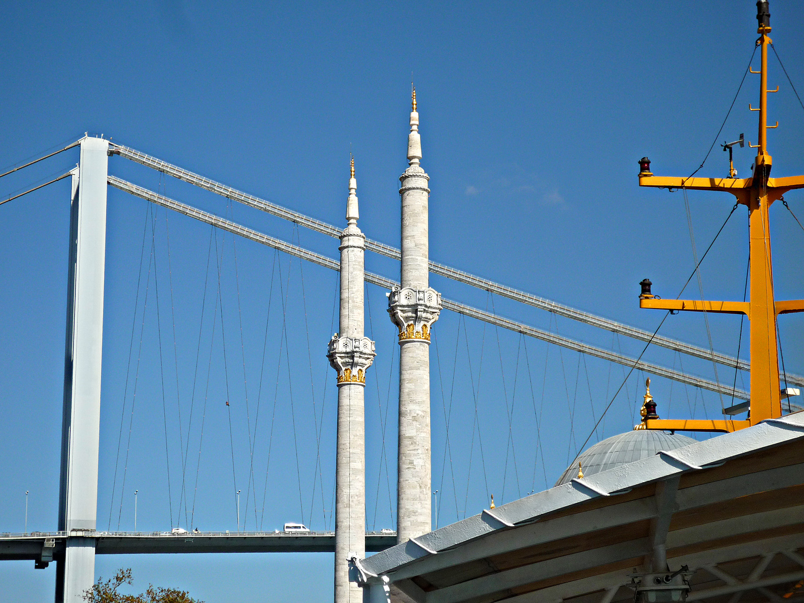 The dome and minarets of Istanbul's Ottoman-era Ortakoy Mosque flank the bridge towers at the European end of Turkey's Bosphorus Bridge; to the right is the superstructure of a ship passing through the strait.
Nov 19, 2014
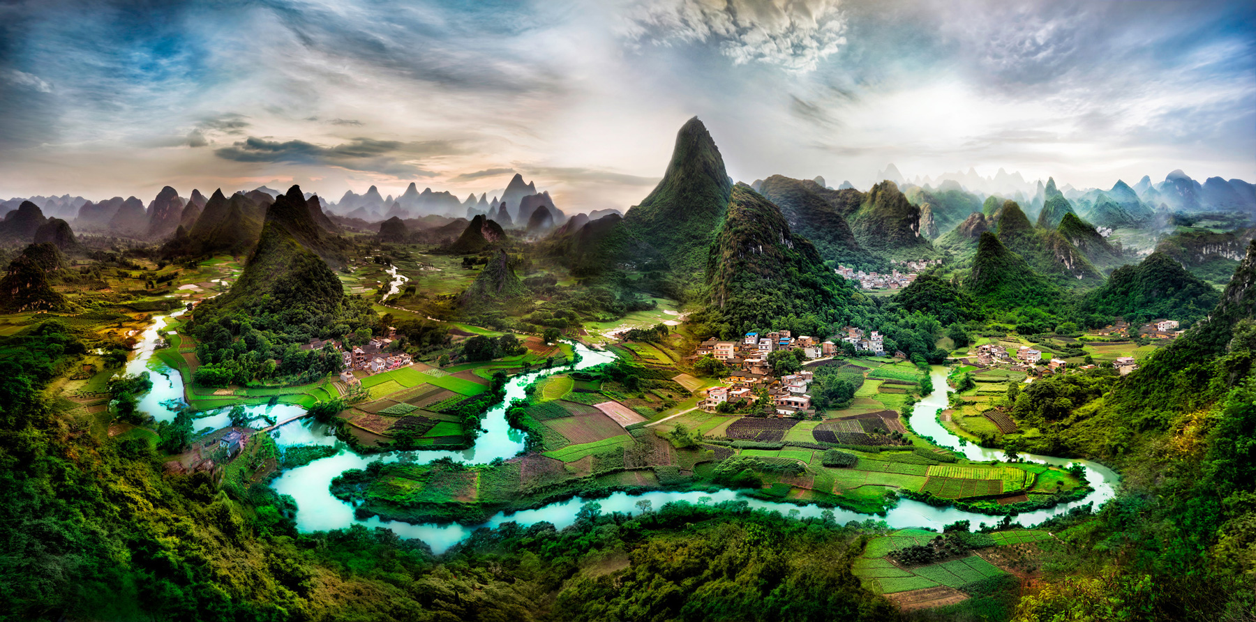 "Deep in the Guangxi Province of China," by Trey Ratcliff.
Dec 13, 2014
 Detail from "Tropical Rainforest with Waterfall" by Ana Uribe (1999), a mural in the Kensington neighborhood of Philadelphia.
Dec 14, 2014
 "Boys from Dead Ox Flat waiting for the school bus in the morning. Malheur County, Oregon."
Dorothea Lange took this picture in October 1939 for the Resettlement Administration. During the mid-1930s, the desert country of eastern Oregon and southwestern Idaho attracted thousands of Dust Bowl refugees seeking construction work on the Owhyee dam and irrigation project; as the project came on line between 1935 and 1939, thousands more refugees sought agricultural work on the newly irrigated cropland.
The name on the mailbox behind the boys is revealed in another of Lange's photos of the same scene: H.E. Hudgins. According to the 1940 census, Herbert and Jessie Hudgins lived thereabouts--but with only two children, an eleven-year-old girl and a six-year-old boy. Herbert Hudgins worked as a ditch rider, assigned to travel the length of the new canals and laterals, cleaning out debris and opening and closing the check boards that control the flow of water to different growers' acreage.
The boys look to be wearing new clothes and fresh haircuts, perhaps because the photo was taken on the first day of a new school year. The picture is dated from the month of October, but this was a time and place where school would not begin until after the year's harvest was in.
Dec 30, 2014
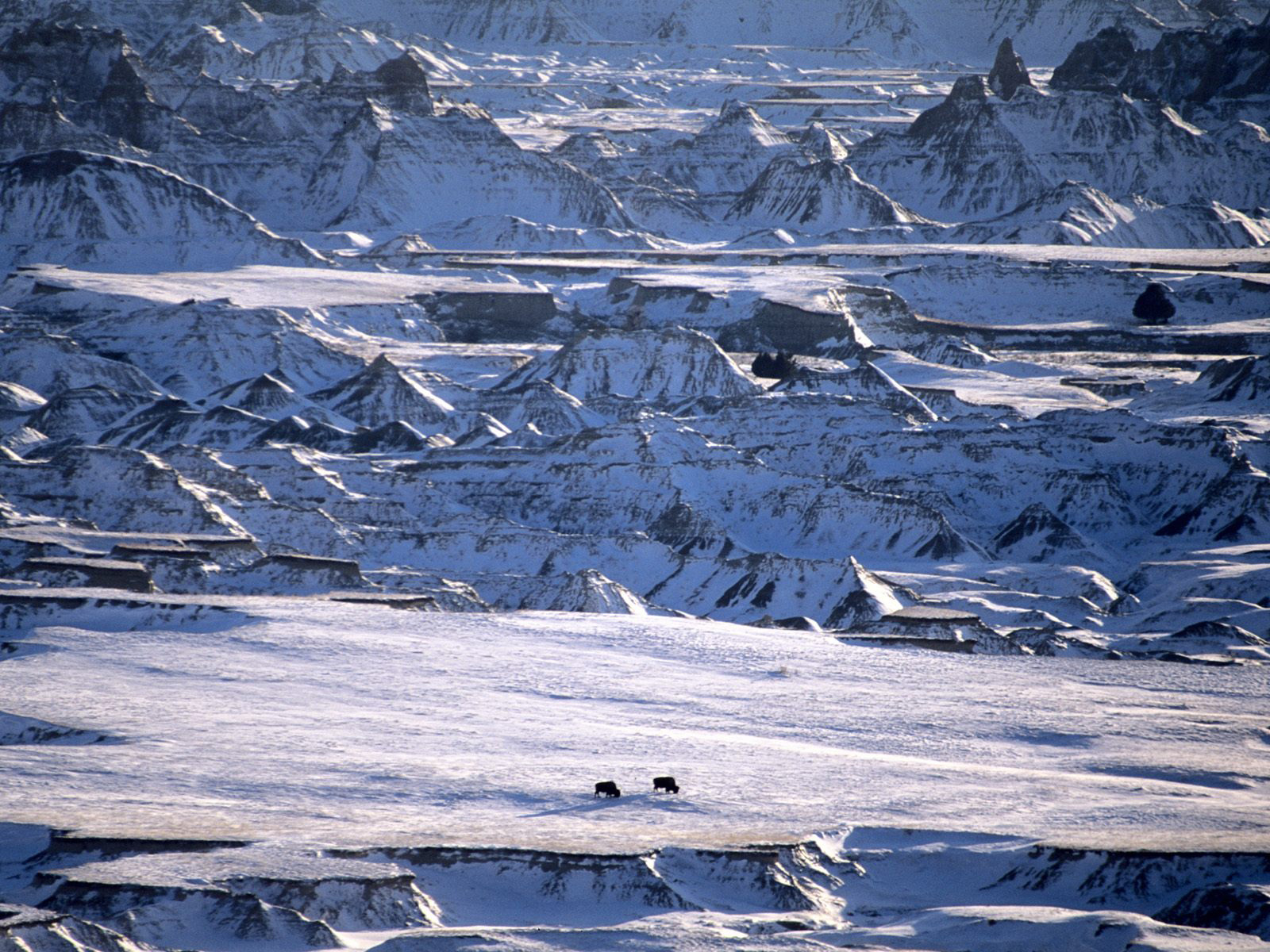 A couple of bison from the thundering herd, in winter, in Badlands National Park.
Jan 1, 2015
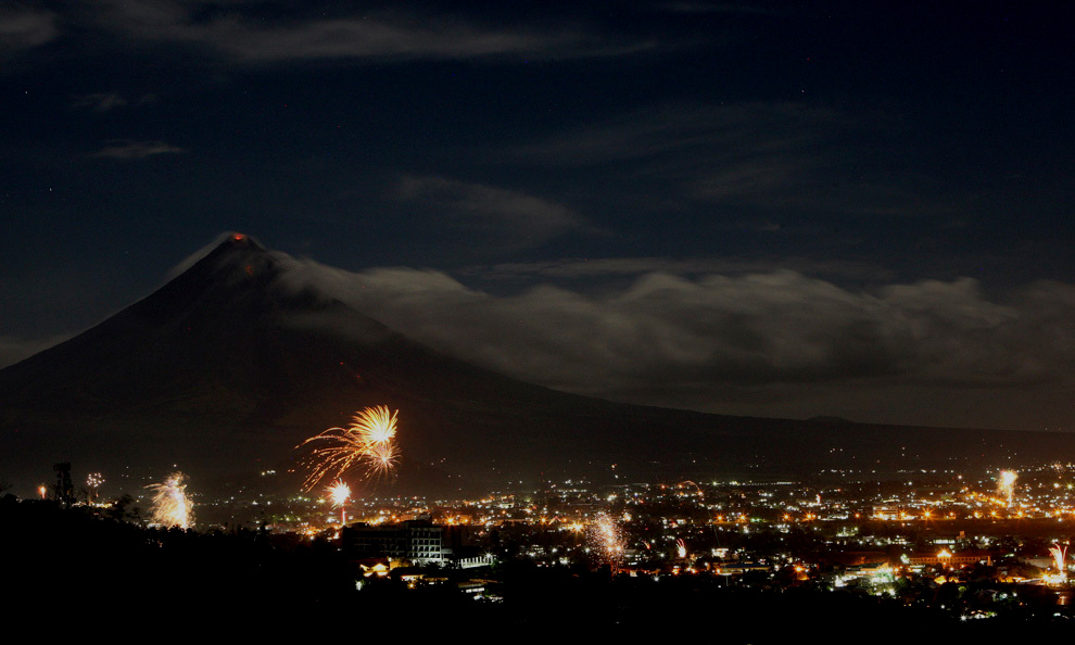 In the earliest moments of the year 2010, the people of the Filipino city of Legazpi, south of Manila, celebrated with fireworks, as the Mayon volcano in the distance stirred up some fireworks of its own.
As we slip slide into 2015, here's hoping we all stay warm and healthy and full of sparks. And where's that cup of kindness when we need it?
Jan 4, 2015
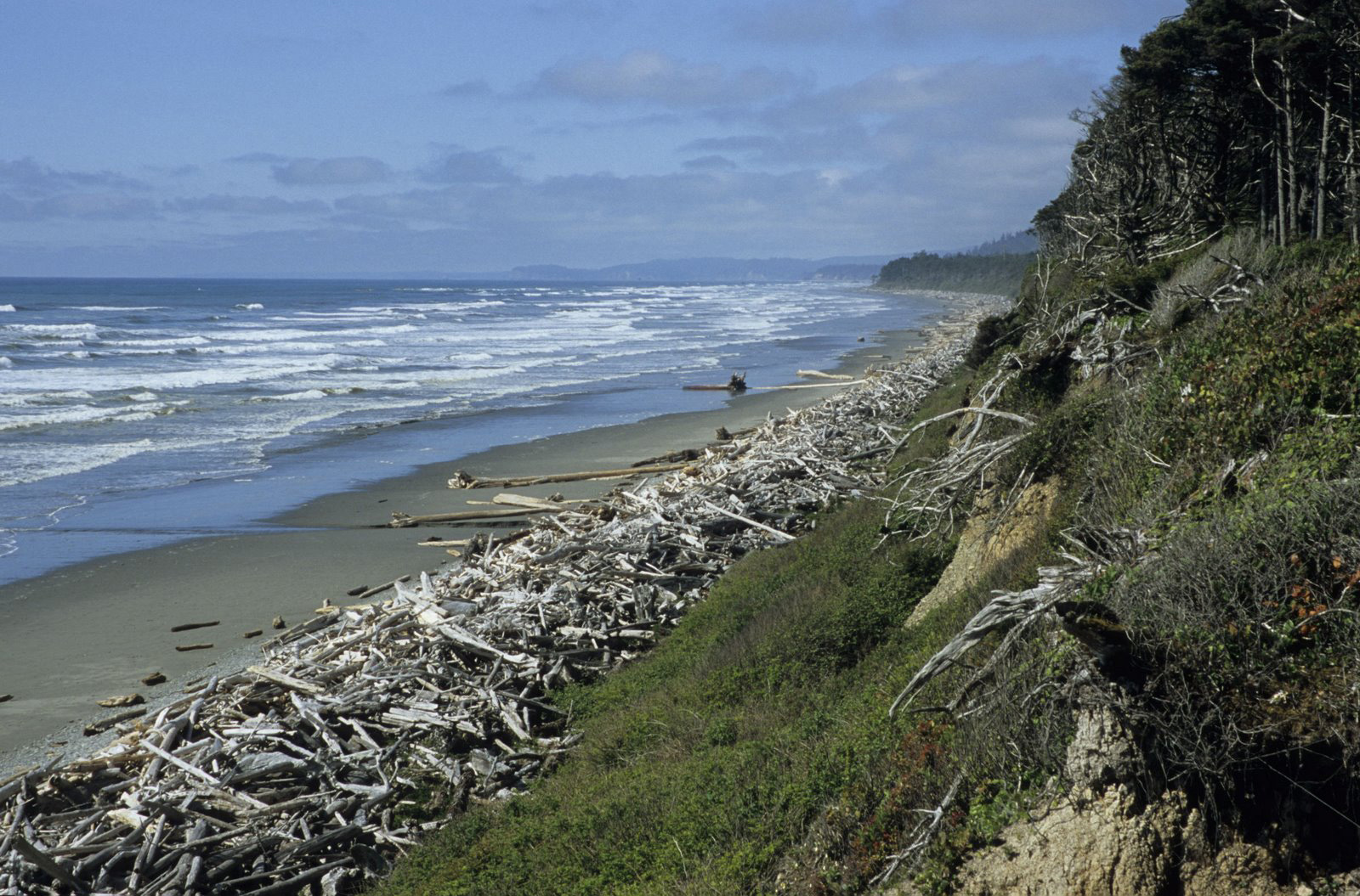 Pacific Ocean beach near Kalaloch, in Olympic National Park.
Driftwood arrives naturally on beaches in the Pacific Northwest; storms, erosion, and ordinary old age can cause trees growing in thin soil on steep slopes to tumble down into inland creeks and rivers; when the rivers are running high and fast, entire forests can be floated right on out to the coast.
Jan 5, 2015
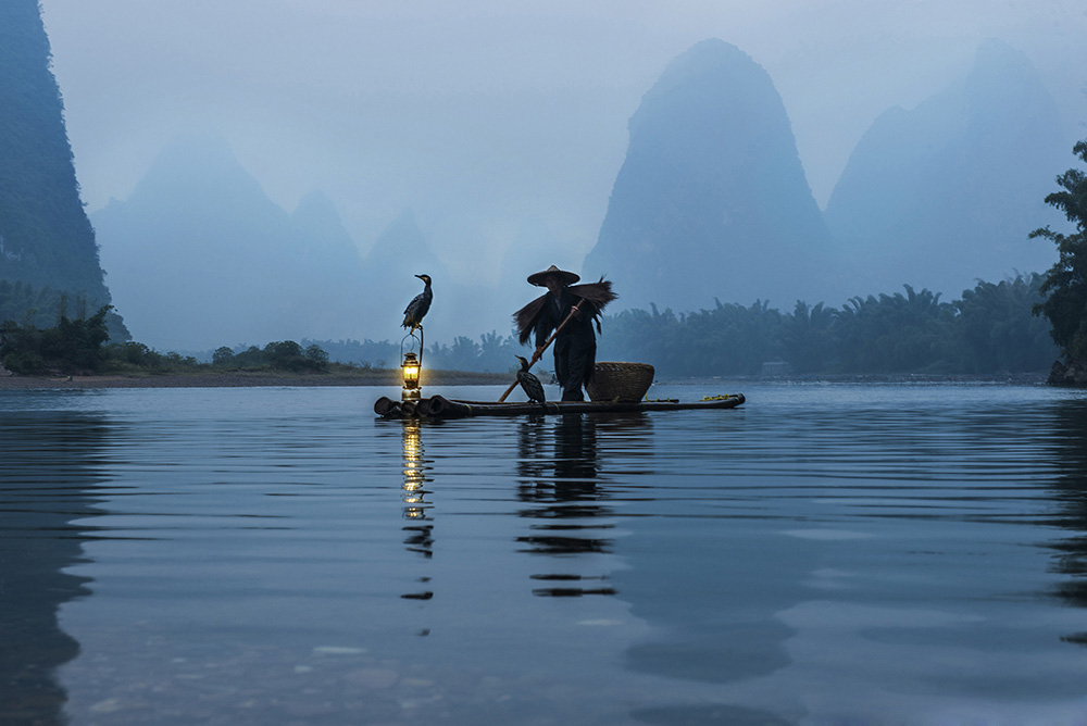 A fisherman goes out at night with his cormorants on the River Li, amidst the karst spires of south China. The photo does not make clear how he monetizes his fishing in these postmodern times: by selling fish, or by entertaining tourists?
Feb 3, 2015
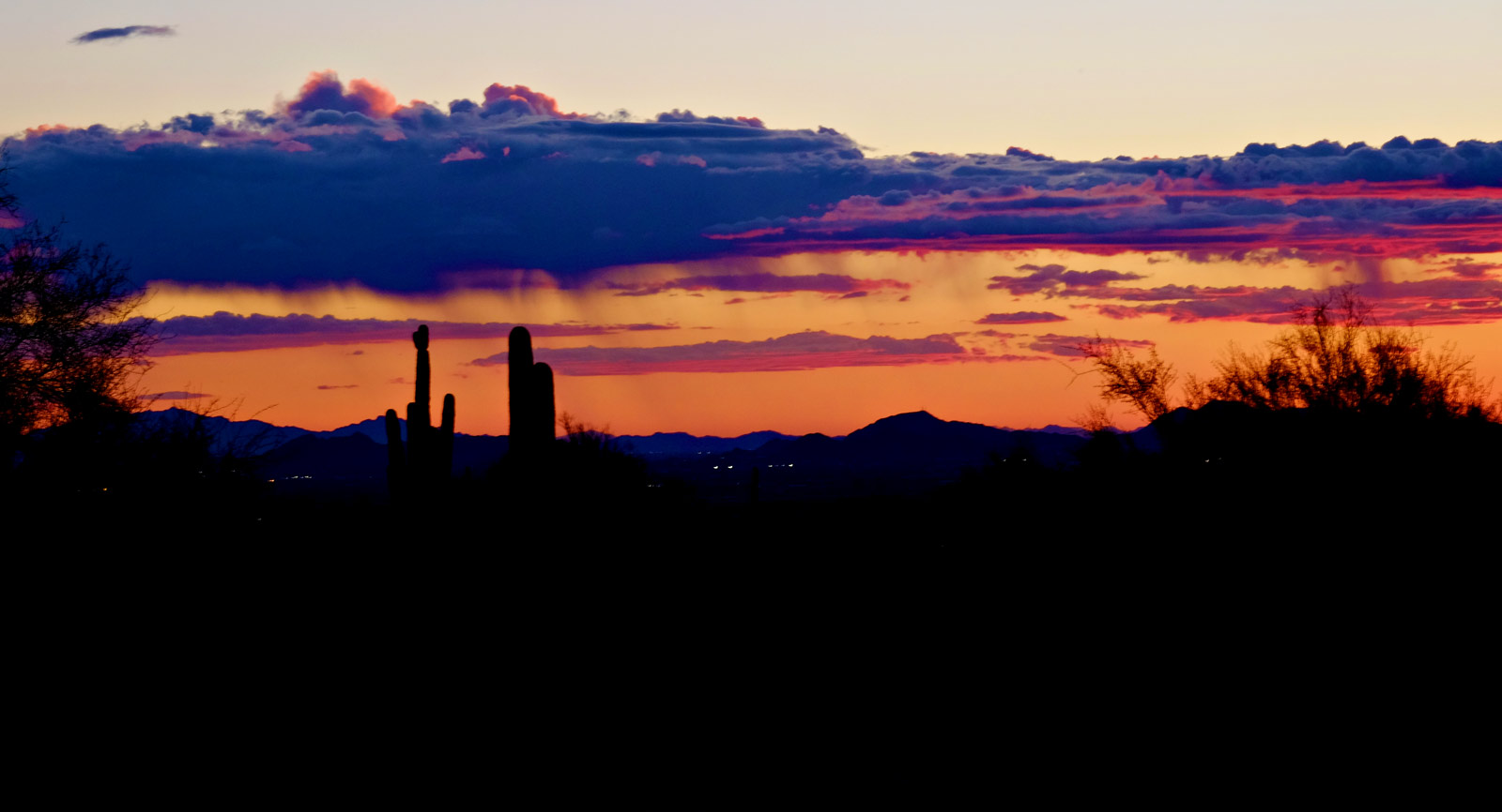 A couple of weeks ago, in the desert near Pinnacle Peak, outside of Phoenix, people who stepped out of their cars to savor the sunset felt the wind pick up suddenly, blowing hard and cold and carrying . . . raindrops? Really?
Careful examination of clouds in the distance revealed ragged curtains of rain showers swirling down just below the cloud line. Apparently, most of the rain evaporated long before moistening the dust, but we can vouch for several drops, perhaps even several dozens of drops, that fell all the way to earth.
After a few minutes, the wind died down, and the storm, such as it was, no longer was.
May 23, 2015
 Night comes to NE 78th Street in Seattle.
A few stray power lines hint at the electrical substation down the hill but don't even come close to hiding the Olympic Mountains on the horizon.
Feb 25, 2016
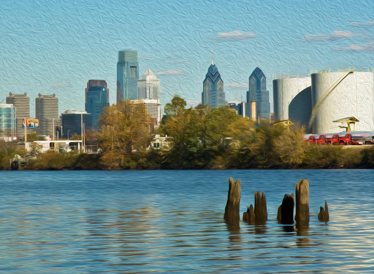 In the mid-eighteenth century, Ben Franklin's good friend John Bartram was a nurseryman, with a plant and seed business on a few acres across the Schuylkill River from Phladelphia. This is the view today from Bartram's estate, which is now owned by the city.
The oil tanks are part of the largest refinery complex in the northeast, recently acquired from Sunoco by an investment fund that operates it as Philadelphia Energy Solutions. This year's low oil prices don't seem to hurt the storage-and-refinery end of the oil business; PES says it has expanded its operation locally to employ more than 1,000 people and is trying to acquire a storage facility in North Dakota.
Bartram had an international reputation as a botanist, collecting seeds and plant specimens from all over the thirteen colonies and beyond, from Florida to Lake Ontario. Much of his traveling was by foot. He sent unique New World plants to London for the king's botanists there; they in turn sent him English plants that might or might not be suitable for American climes, including some trees and shrubs that survive today in Bartram's garden.
His son Bill continued the nursery business and also wrote a best-selling travelogue about plant-collecting adventures. Bill's niece Ann then took over the place and expanded it to include ten greenhouses and many acres of nursery gardens; in 1850, however, Ann and her husband Bob Carr ran out of money and had to sell the place.
Mar 6, 2016
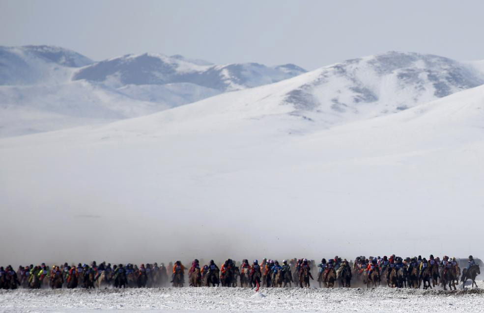 Early March in Mongolia is horse-racing season.
Mar 10, 2016
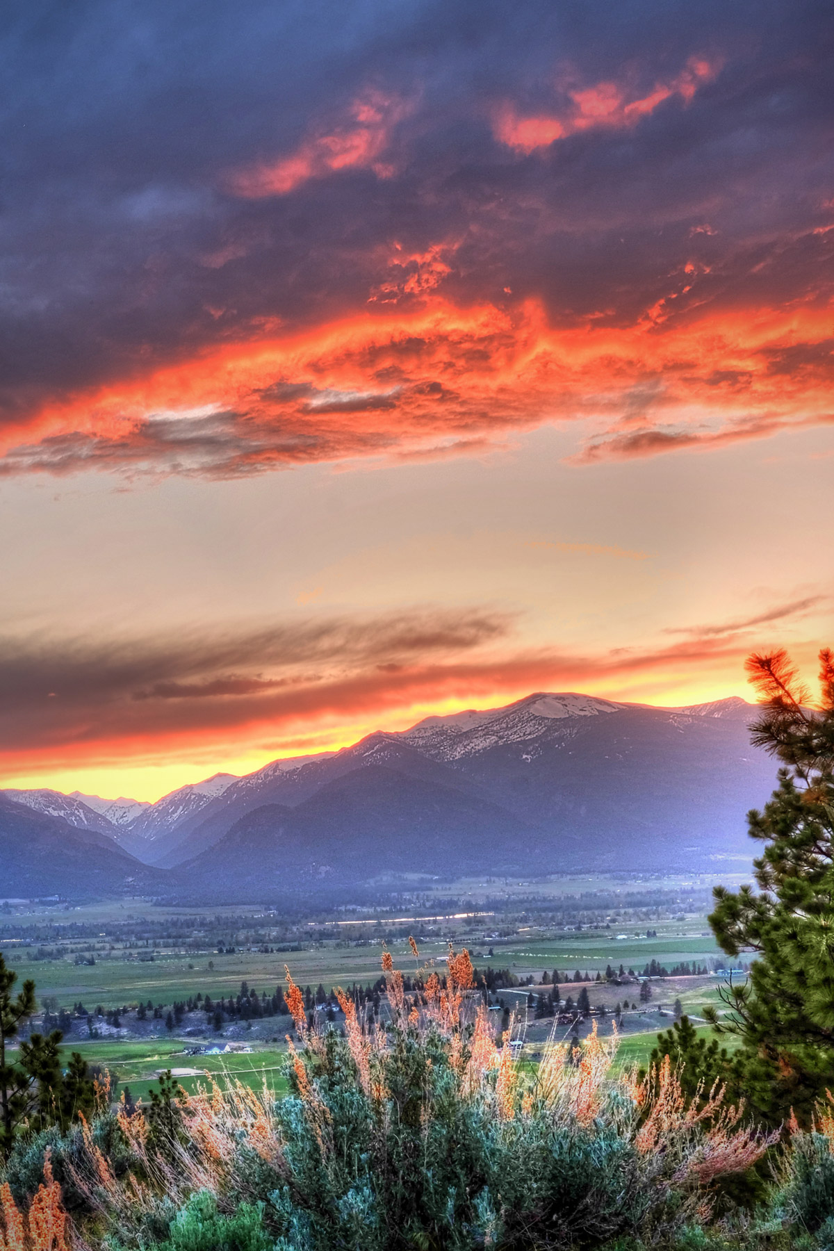
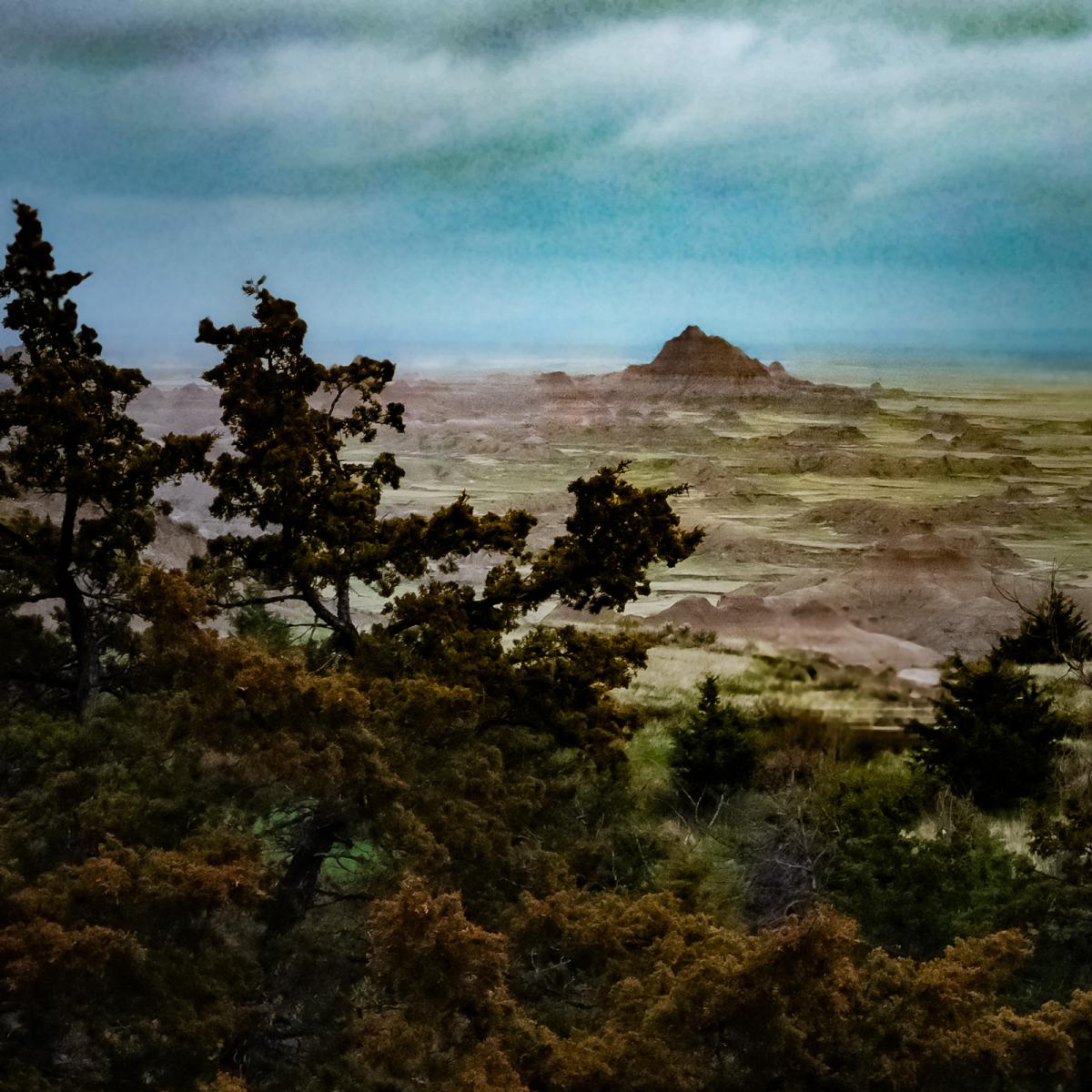 Here in Philadelphia, the sun is smiling on us this week; it feels like spring, and it will look like spring very soon. We'll know it when we see it. Even in South Dakota's appropriately named Badlands, where life is tough and the weather is bad pretty much all seasons of the year, faint green hints of spring can be discerned in the landscape–not in March, however; the photo above was taken in mid-May 2014.
Mar 16, 2016
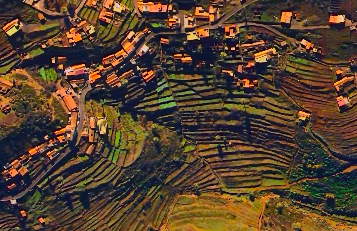 A birdseye view of farmland on the volcanic slopes of the Canary Islands.
Mar 26, 2016
 Right now! Along Highway 111.
Apr 1, 2016
 We have a new dog in the family, Hank's shaggy pup Mabel. She's a cross between an Australian Shepherd–which is actually an American breed with no connection to Australia–and an Australian Cattle Dog–which is actually an Australian cattle dog. The two breeds are often crossed to produce a kind of sturdy, active, people-oriented working dog that's sometimes called a Texas Heeler.
Hank tells us that Mabel, who's seven months old, is the world's smartest dog. She's smart enough, obviously, to know when she's got a good thing going.
Jun 10, 2016
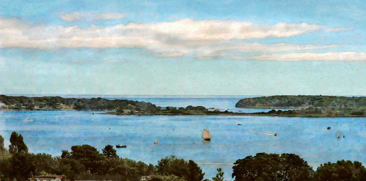 A nice day on Casco Bay, as seen from the Portland Observatory, the city's old maritime signal tower atop Munjoy Hill.
Jun 18, 2016
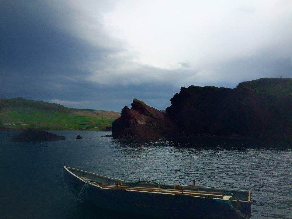
"I went hiking one morning at about 5 am and found this boat," Ted told his Facebook buds, referring to a morning last month when he was in Dingle, a town on the far southwestern coast of Ireland.
"I wanted to sneak it out for a ride soooo much," Ted continued. "But somehow, I managed to refrain from stealing the boat. Sadly."
That was the short story. Recently, we learned the long story–which is really only a little bit longer–during a recent conversation with our traveler, now home again in Tedland, West Virginia.
Of course he wasn't going to steal the boat; the idea was just to borrow it. And it wasn't locked. It was just tied up with so many ropes, so many knots, big knots, tight knots, and it was five in the morning, way too early to be fussing with lots and lots of tightly tied knots.
In other words, sadly, Ted was too lazy (hungover?) to take the boat. So he kept on walking.
Feb 14, 2017
 The harsh, moody climate and mysterious, treeless landscapes that define the western Nordic islands–Iceland, Greenland, the Faroe Islands–are swept up somehow and transformed by imagination into a fashion sensibility, the focus of the Third Nordic Fashion Biennale.
Curators Sarah Cooper and Nina Gorfer–American and Austrian by birth, Stockholm-based photographers by choice–have produced an exhibition, book, and film they call The Weather Diaries, which explore fashion as a wind-blown wonder.

Feb 18, 2017
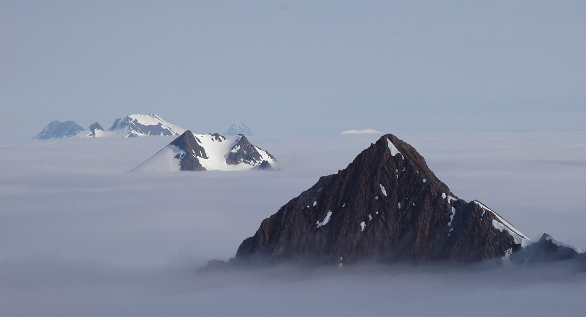 Below the clouds below these peaks, as seen from Bear Mountain, it was pouring down rain in Sitka, Alaska.
Mar 18, 2017
 An uncropped version of this photo took first place in a contest defined as "Big rivers and the life along them." It was shot with an Android cellphone.
The river is the Li, in south China, and the lively village is Fenghuang.
Apr 20, 2017
 Kevin Horan, the goat portraitist featured in this space yesterday, lives on Whidbey Island, Washington, where he's developed this thing about ferry boats.
"Every islander knows the mind space within a ferry," he writes. "In transit, you are in neither one world nor the other." He shot a series of long-exposure ferry scenes to emphasize how the vessels "track across the water like UFOs across the sky." Ferries are "magical mystery transport pods."
This is the view from Fisherman's Bay on Lopez Island of the Friday Harbor ferry at dusk. In the distance are the city lights of Vancouver, British Columbia, reflected in the clouds behind Mount Constitution on Orcas Island.
Jan 5, 2018
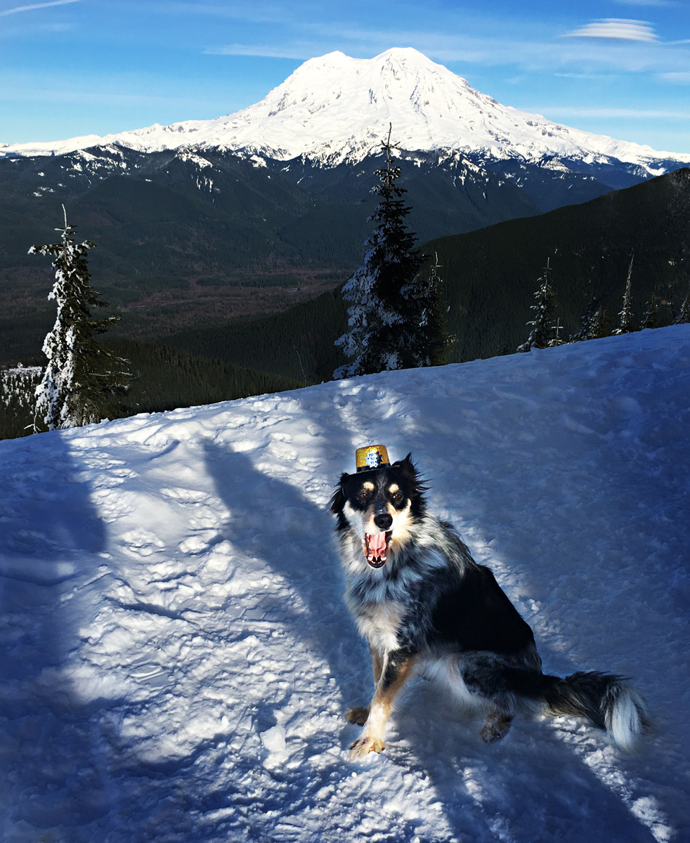 Mabel sits and yawns on a sunny ridge near Mount Rainier last week, showing off her Happy New Year hat.
Jan 6, 2018
 In the wintry weather currently gripping eastern North America, icy mounds of frozen spray, known as sugarloaves, are growing huge atop frozen rivers below not-quite-fully-frozen waterfalls. There's a sugarloaf at the base of Niagara Falls this year, and also one at Montmorency Falls near Québec City; the falls at Montmorency are some 98 feet higher than Niagara and are located almost a thousand kilometers to the northeast, in a climate zone where every winter is plenty cold enough to make a sugarloaf.
The painting shown above, The Ice Cone, by Robert Clow Todd, shows Montmorency Falls and its sugarloaf in the winter of 1845. The place looked pretty much the same when we visited, in the winter of 2004, minus the horses, of course.
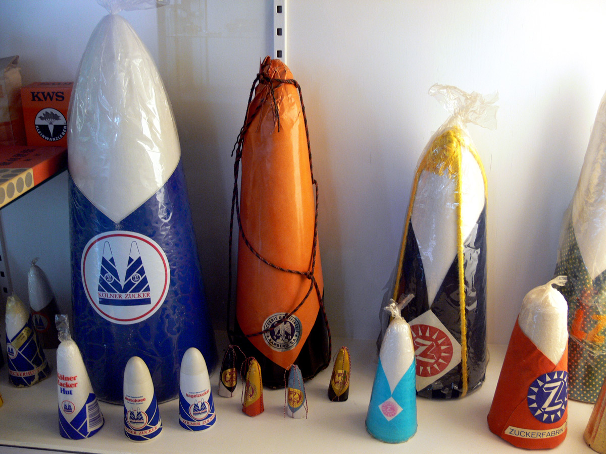
Tall, cone-shaped things with slightly blunted tips are often called sugarloaves, especially if they are ski resorts or a mountain in Rio de Janeiro with a statue on top. That's because real, old-school sugarloaves–actual hard, solid loaves of refined sugar–were produced in molds shaped like that. Up until the end of the nineteenth century, when manufacturing processes emerged to refine sugar into a granulated product, people who could afford to buy white sugar–meaning rich people–bought it by the loaf, which might weigh as much as 30 or 35 pounds. They chipped off pieces as needed, using heavy, sharp-edged pliers known as sugar nips.
The sugarloaves pictured below are on display in the Sugar Museum in Berlin.
Jan 9, 2018
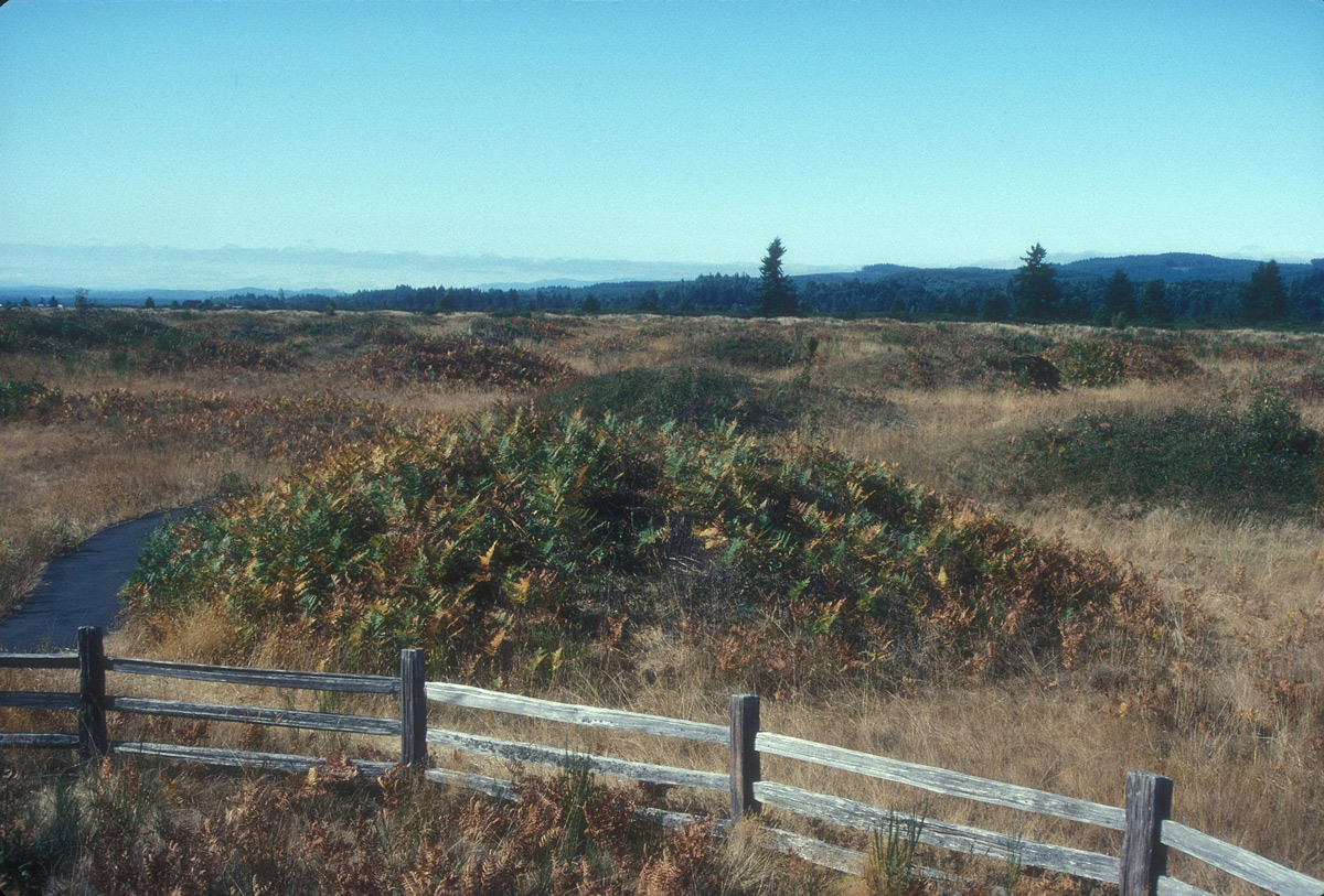
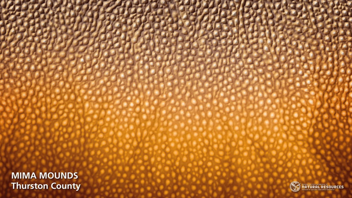 Near the southern extreme of Puget Sound, around Olympia, Washington, are hundreds of acres of bumpy grassland, the Mima Mounds. The picture above–aerial imagery produced by a radar-sensitive LIDAR camera–shows what the Mima landscape looks like without all the grass and shrubs that soften the lumpy appearance. the picture below shows what it looks like to the human eye.
LIDAR is a radar technology used to determine elevation, and it works even when the actual ground level is hidden underneath vegetation or buildings; when a plane flies over an area of interest and sends radar signals straight down to earth, the signals will bounce back differently depending on what they hit. Of course you need a computer to sort it all out, but they've got computers.
What the computers haven't been able to figure out is what caused these mounds, which are pretty much all very round and low and flat; in the Mima prairie, most of the mounds are about 3 feet high and 30 feet across. They are gravelly dirt, just like the spaces between them.
Similar-looking mounds are found in dozens of other places, and no single mechanism has been identified that might account for them everywhere. Among the possible processes that have been researched in the Mina region: earthquakes shaking the soil, clay minerals shrinking and swelling in the soil, windblown dunes forming around vegetation, and–our favorite–burrowing by pocket grophers, perhaps with help from termites and ants.
Scientific consensus on this matter has yet to emerge.
Jan 11, 2018
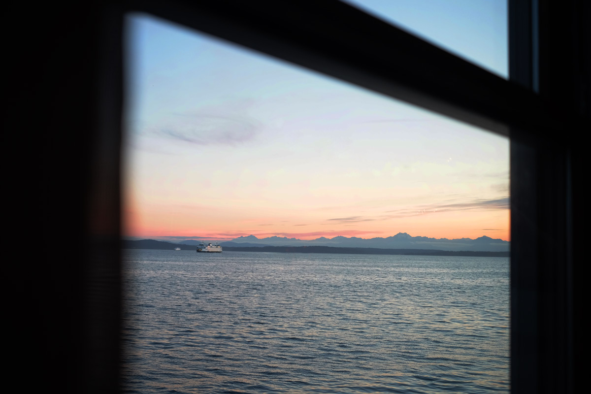 The Bainbridge Island ferry and the Olympic Mountains at sunset, as seen across Elliott Bay from the bar at Pier 67 near downtown Seattle.