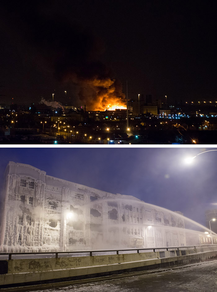
On a cold night in January, more than two hundred firefighters from all over Chicago battled a huge blaze in the Harris Marcus warehouse in the city's Bridgeport district. The job was complicated by extreme cold, as hydrants froze and ladders iced up; the water department was called in to de-ice the ladders with steamers.
The next day, embers in the smouldering ruin reignited, and firetrucks had to go back there and spray even more water.
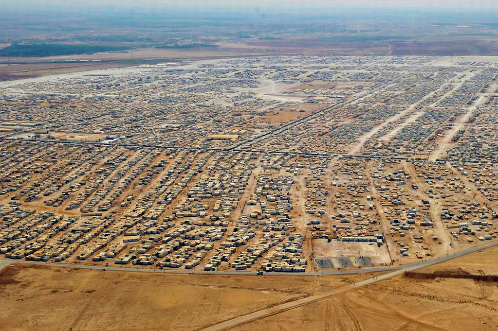
This camp at Zaatari in northern Jordan just marked its first anniversary. Refugees fleeing the Syrian civil war have flooded in so fast that attempts at accurate headcounts have been abandoned. Back in March and April, when the fighting was especially intense, the influx from Syria was estimated at 5,000 to 10,000 new refugees every day.
The current camp population is believed to be approximately 144,000, making Zaatari the fourth largest community in Jordan.
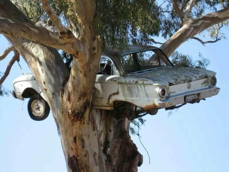
Actually, it's a nesting Falcon. I do not pretend to know what this is all about, except that I understand the bird and almost certainly also the tree are Australian.
Go ahead. Laugh, all you kookaburras. Gay your life must be.
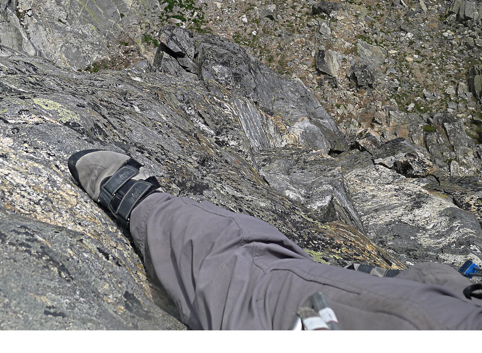
The climb must have been going pretty well, straight up the wall of Mt. Gimli, in Canada's Kootenay Rockies. And then Hank stopped for a moment and looked down.
We might speculate that looking down would be a terrible thing to do. But all the evidence suggests that Hank just calmly snapped a picture of his own right foot and then went back to climbing on up.
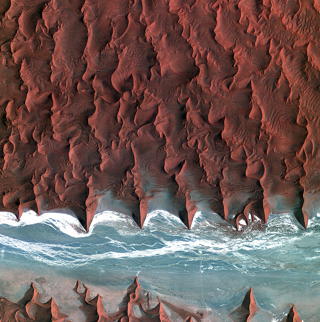
Well, of course now that our American space program is shut down because of hateful people in the House of Representatives, the brand new Landsat 8 satellite that you and I paid for, which had just started phoning in dramatic new views of our planet, has gone dark. But fortunately, many other countries have legislatures that don't seem to go quite so insane over efforts to help people get medical care, and so new earth imagery from foreign satellites is still available to us.
This is the view from Kompsat 2, a Korean satellite, as it crossed southern Africa above the Namib Desert on the morning of October 5. What appears to be blue water is actually an ancient riverbed, almost entirely dry for millions of years; the white streaks are bone-dry salt flats.
Click to zoom in and see roads in the riverbed and some black dots that represent the only vegetation for hundreds of square miles; These desert shrubs survive on groundwater, of which there is hardly any; such as is there is, however, collects deep underneath the riverbed, below the gullies where water does trickle on those rare occasions when it rains here. Annual precipitation is less than half an inch on average, though it is supplemented a bit by coastal fog.
Note the short spur leading off the main road near the middle of the scene and ending at the base of a dune. This is the route to a parking lot at Dune 45, a thousand-foot high sand dune popular with tourists.
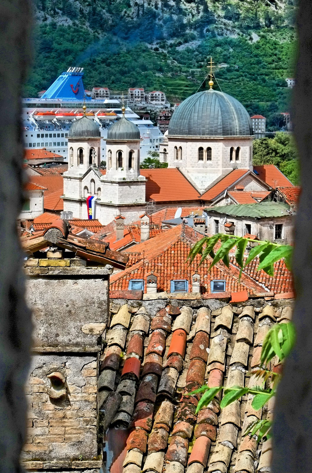
The Montenegran town of Kotor, as viewed through an opening in its Byzantine-era fortifications. Behind the domes are smokestacks of one of the umpteen dozen cruise ships that visit Kotor nowadays while steaming along the Dalmatian coast.
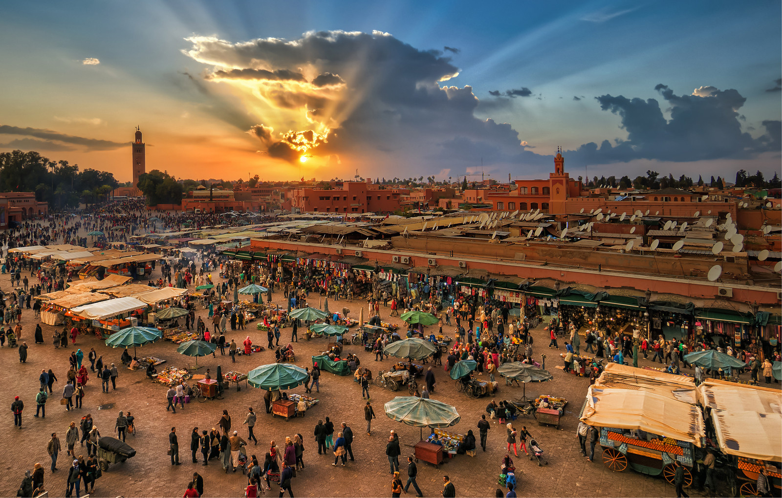
Up the road a ways past Casablanca in Morocco is the ancient Berber city of Marrakech, famed for its gardens and palaces and especially for its sprawling, labyrinthine markets.
Click on the picture to, um, biggenize it, to glimpse what's on display in this souk and also, perhaps, to check the accuracy of our unofficial count: mounted on rooftops visible here are at least 104 satellite dishes.
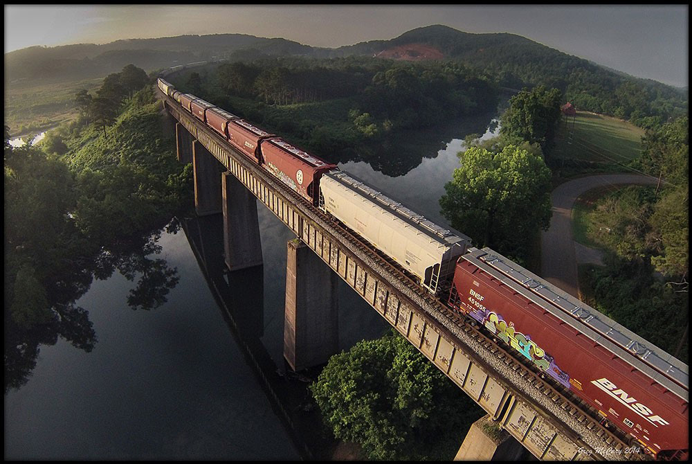
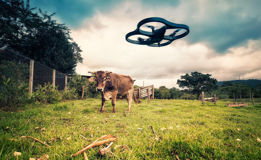
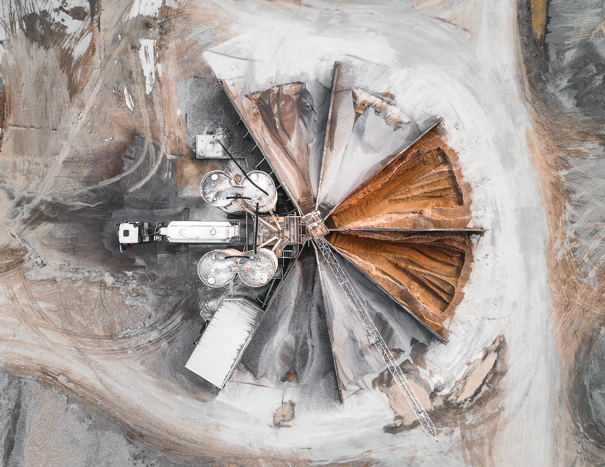
All the cool kidz nowadays–all the cool kidz who have a little too much money–or is too much money one of the requirements for cool kidz status?–anyways, what they're playing with these days is the latest and greatest in technology for drone photography.
Little plastic remote-controlled flying saucers carry cameras aloft and point the lenses back down at us. Sometimes the things crash–for example, onto the balcony of an apartment on a high floor of a New York skyscraper–but sometimes they capture astonishing views of life here on the surface of earth.
To get the shot above, Greg McCary flew a drone up over the hills and rivers of Bartow County, Georgia, northwest of Atlanta. Below, Mauricio Lima's venture into drone photography attracted the attention of a wary neighbor.
Our last look at Iceland's ongoing volcanism touched on matters of earthquakes, a collapsing caldera, magma, lava, and tectonic rifting. But we failed to discuss the issue that has come to preoccupy Icelanders in recent months: poison gas, which spreads across the island as a blue haze, threatening the health of people, livestock, crops, and vegetation.
The gas belches out of the lava as sulfur dioxide, SO2, which is the odor we sniff in minute amounts when we strike a match. Around the site of the eruption, in barren terrain near central Iceland's Bardarbunga volcanic complex, the sulfur dioxide is so intensely concentrated that a single breath could be fatal. Fortunately, no one lives nearby; researchers approaching the volcanic vent wear elaborate gas masks and stay in the vicinity for only a few minutes at a time.
In addition to being dangerously sulfurous, the air near the eruption is also extremely turbulent. Steam from the vent and heat gusts from the surface of the lava lift and disperse the SO2 quite quickly. Early in the eruption, huge pulses of steam pushed the gas so high into the atmosphere that it was entrained in the jet stream and carried in low but measureable concentrations across the sea to northern and western Europe.
Within a few days, however, as the volcanic vent opened fully, the lava spilled out less forcefully. Sulfur dioxide was no longer blasted into the upper atmosphere; instead, it has settled as a smoggy blue haze, rolling along the surface of Iceland. The haze is steered by winds; an east wind blows it into Reykjavik, as seen above, while winds from other points of the compass blow it to every nook and cranny of the island.
When the haze is bad, Icelanders are told to stay indoors, close their windows, and run their heat full blast. Measured concentrations are well above known hazard levels, and people with weak lungs or compromised immune systems face serious health risks. Even healthy people experience burning eyes and throats, headaches, fatigue, and various degrees of breathing difficulties. Those who have to stay outdoors try to keep nose and mouth covered and are warned to avoid heavy exertion.
But the symptoms are temporary; the wind changes, the blue haze disappears, and everybody feels better. Children are allowed back outside to play.
The haze is not pure sulfur dioxide. It's more insidious than that. The SO2 combines with water vapor in the volcanic steam and the general atmosphere to produce aerosols of sulfurous acid, H2SO3, one of the principal components of acid rain.
And that's not the worst of it. The H2SO3 reacts with oxygen in the air to create a much more corrosive, extremely dangerous compound: sulfuric acid, H2SO4.
People can protect themselves from the worst of all this, but animals and plants, of course, are entirely exposed. They will suffer long-term effects. Iceland's last high-sulfur volcanic eruption, known as Laki, killed three-quarters of the country's livestock in 1783 and led to massive crop failures. Thousands of people died of starvation.
The volume of lava and sulfur spewed forth by Laki, however, is believed to be about fifteen times the amount currently erupting from Bardarbunga–500,000 metric tons daily from Laki, as opposed to 35,000 tons daily from Bardarbunga.
The current sulfur emissions are roughly comparable to the amount already entering the air every day from all the smokestacks in Europe. Iceland is a tiny place to be dealing with as much poison in the air as the entire continent of Europe.
The eruption is now two and a half months old. There are no signs that it is winding down just yet; it could continue for many more months, or years.
For what it's worth, sulfur dioxide is not a greenhouse gas; in fact, it blocks sunlight and has an overall cooling effect. As winter darkness envelops Iceland now, there's less and less sunlight to be blocked; if the sulfur is still hanging around next spring, the chill of an Icelandic winter may persist even longer than usual.
In 2009, when Hank was a U.S. Senate page, he got up on top of the Capitol dome one day and snapped this picture, looking down across the roof of the Senate wing of the Capitol building.
It was all clear up there by 2009, but for several years after 9/11, snipers had been posted on that roof and on many other government roofs in Washington.
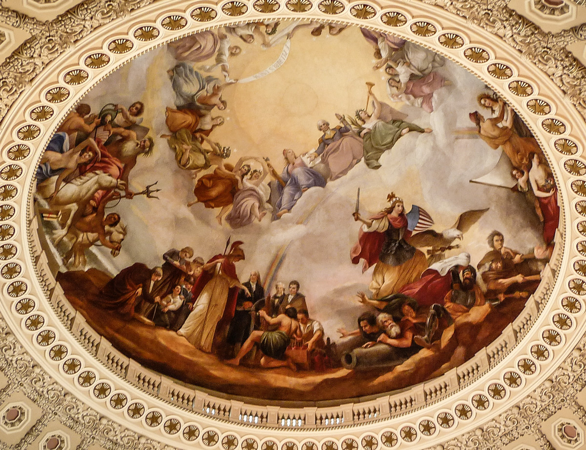
The inner surface of the dome of the U.S. Capitol building is a fresco titled The Apotheosis of Washington, which depicts George Washington in his army uniform, seated amongst the gods of the Roman heavens, surrounded by the entire military-industrial complex.
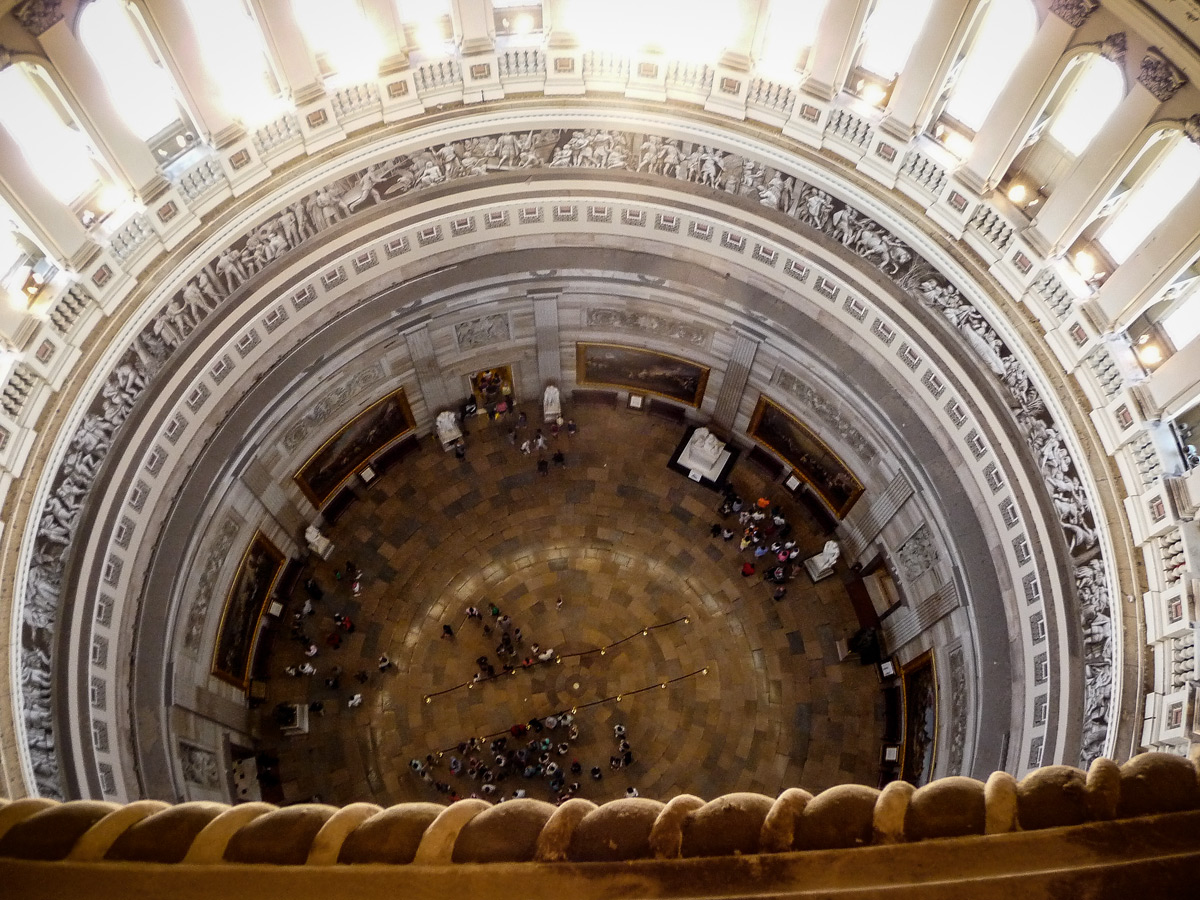
We'll leave the details of this cartoon to another morning. Today, we want to look just beyond the outer circle of the fresco, where it is barely possible to make out the railing of a narrow balcony running all the way around the dome. If you could get up to this balcony, you could look down 180 feet to the floor of the rotunda, or you could turn around to face the outside of the dome and look out across the city.
Here's the inside view, looking down:
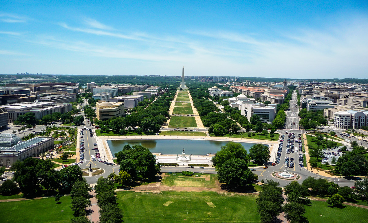
And here's the outside view, looking west along the mall to the Washington Monument:
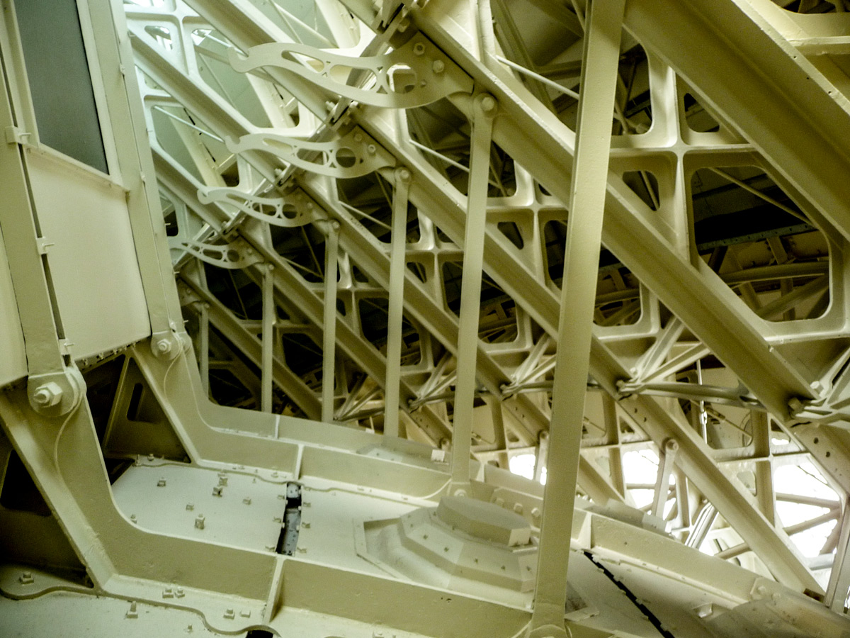
To get up to this balcony, you first have to become an important person, or at least a congressional page. Then you have to navigate steep, winding metal stairs amid the ironwork that supports the dome:
The whole dome is made of iron–8.9 million pounds of iron–painted to look like the sandstone in the rest of the building. It replaced an earlier, much smaller dome made of wood sheathed in copper. When Congress approved funding for the new dome in 1854 ($100,000), construction began by setting up a crane in the middle of the rotunda, with a steam-powered engine that was fueled by burning the wood from the old dome.
The new dome took nine years to build, and then two more years to paint. Work was finished in 1865. During the project's last few years, of course, we were seriously at war with ourselves, but for whatever reason, the dome kept on rising without interruption.
In recent years, it's gotten leaky, and in 2014 the exterior of the whole dome was covered with scaffolding for a two-year roof-patching job.
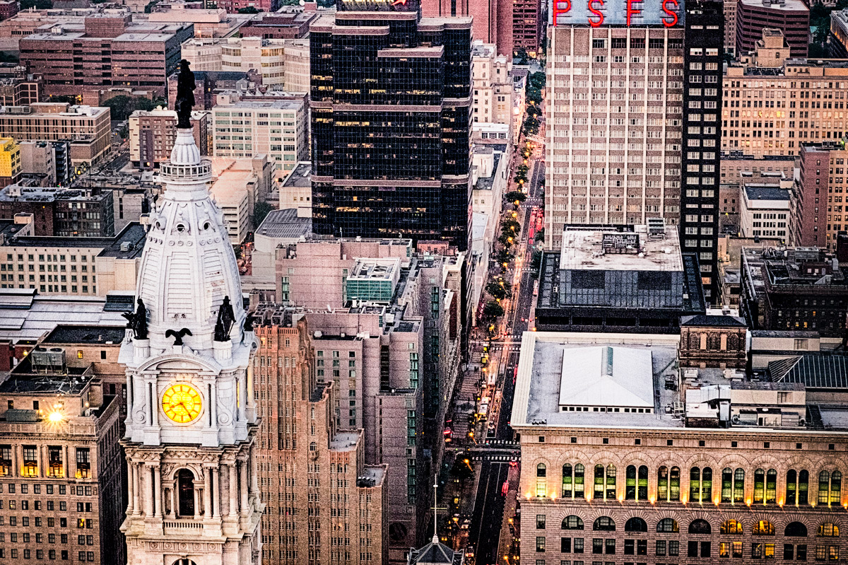
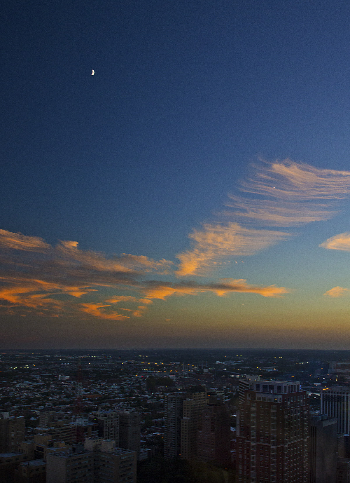
The bronze Ben Franklin standing atop City Hall's dome is said to be the tallest statue anywhere that's on top of a building. He's 37 feet tall and weighs 27 tons.
This picture of Ben from behind was taken from the new observation deck on the 57th floor of One Liberty Place a couple of blocks away.
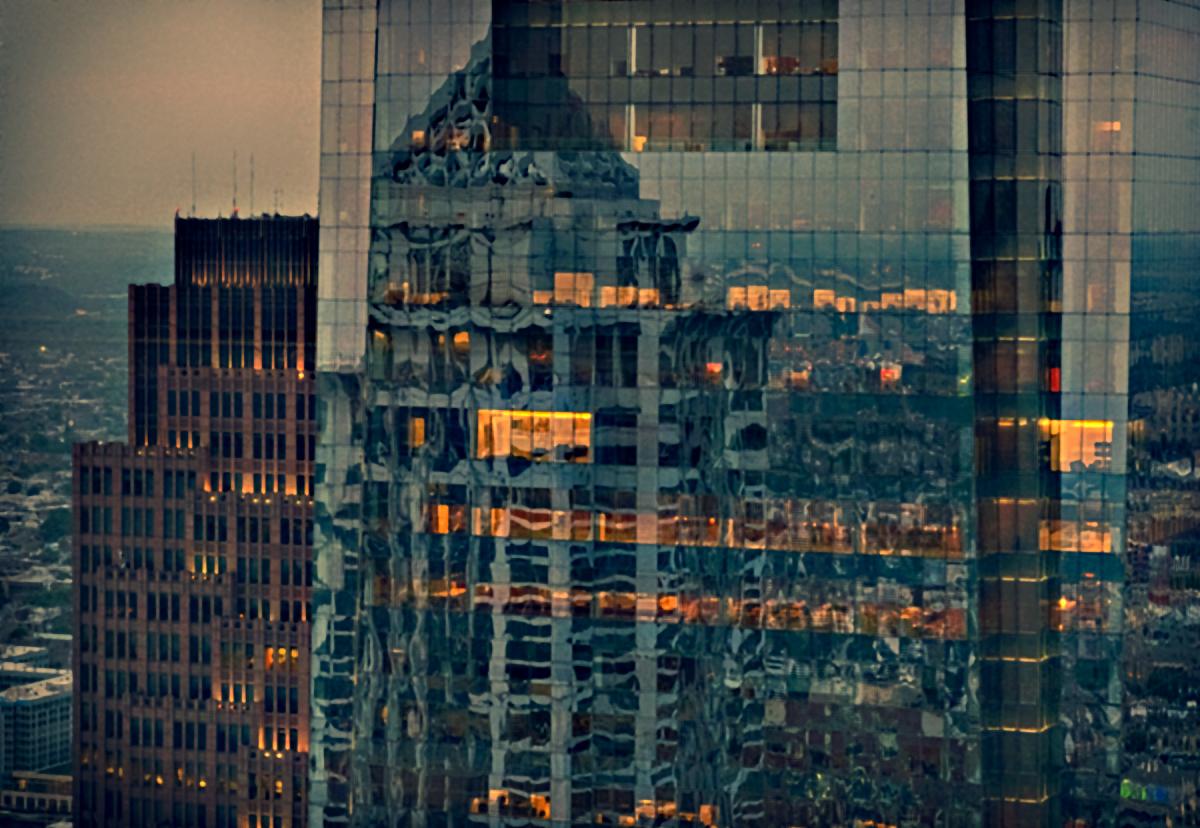
An old skyscraper, the Art Deco Suburban Station building from 1930, peeks out at left from behind Philadelphia's newest and tallest skyscraper, the Comcast Center, completed in 2008. Reflected in the angled blue glass of the Concast tower are the upper floors of the Mellon Bank Center across the street.
Behind the 'scrapers is lots and lots of city sprawling into the night across the Delaware Valley.
Comcast is currently building itself a newer and even taller tower, which is rising off to the right of the buildings seen here. The lower floors will be occupied by Comcast and Telemundo, and the upper floors will be rooms with a view in a Four Seasons Hotel.
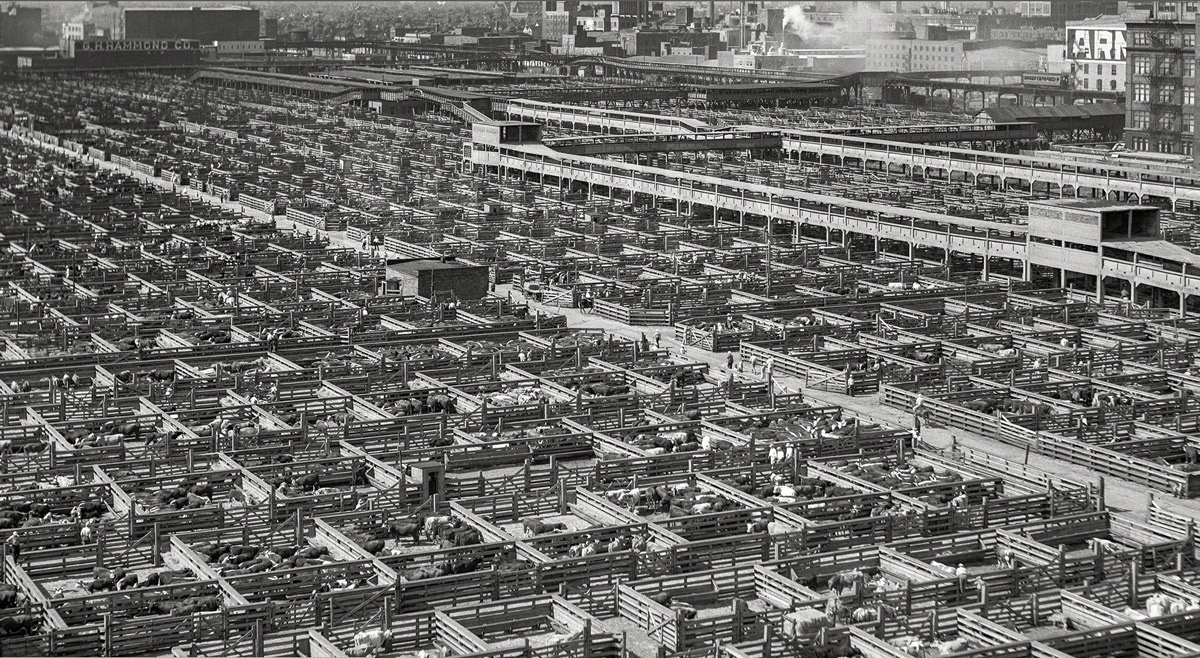
For a hundred years, up until 1971, Chicago's Union Stockyards and surrounding meat-packing plants made the city the meat capital of the universe. The industry gave the neighborhood a definite aroma, but of course, it was still the scent of money.
The city had to make the Chicago River run backwards in order to keep the animal waste out of municipal drinking water.
The stockyards burned to the ground in 1939, but they'd been newly rebuilt by the time of this photo in 1941.
 On a cold night in January, more than two hundred firefighters from all over Chicago battled a huge blaze in the Harris Marcus warehouse in the city's Bridgeport district. The job was complicated by extreme cold, as hydrants froze and ladders iced up; the water department was called in to de-ice the ladders with steamers.
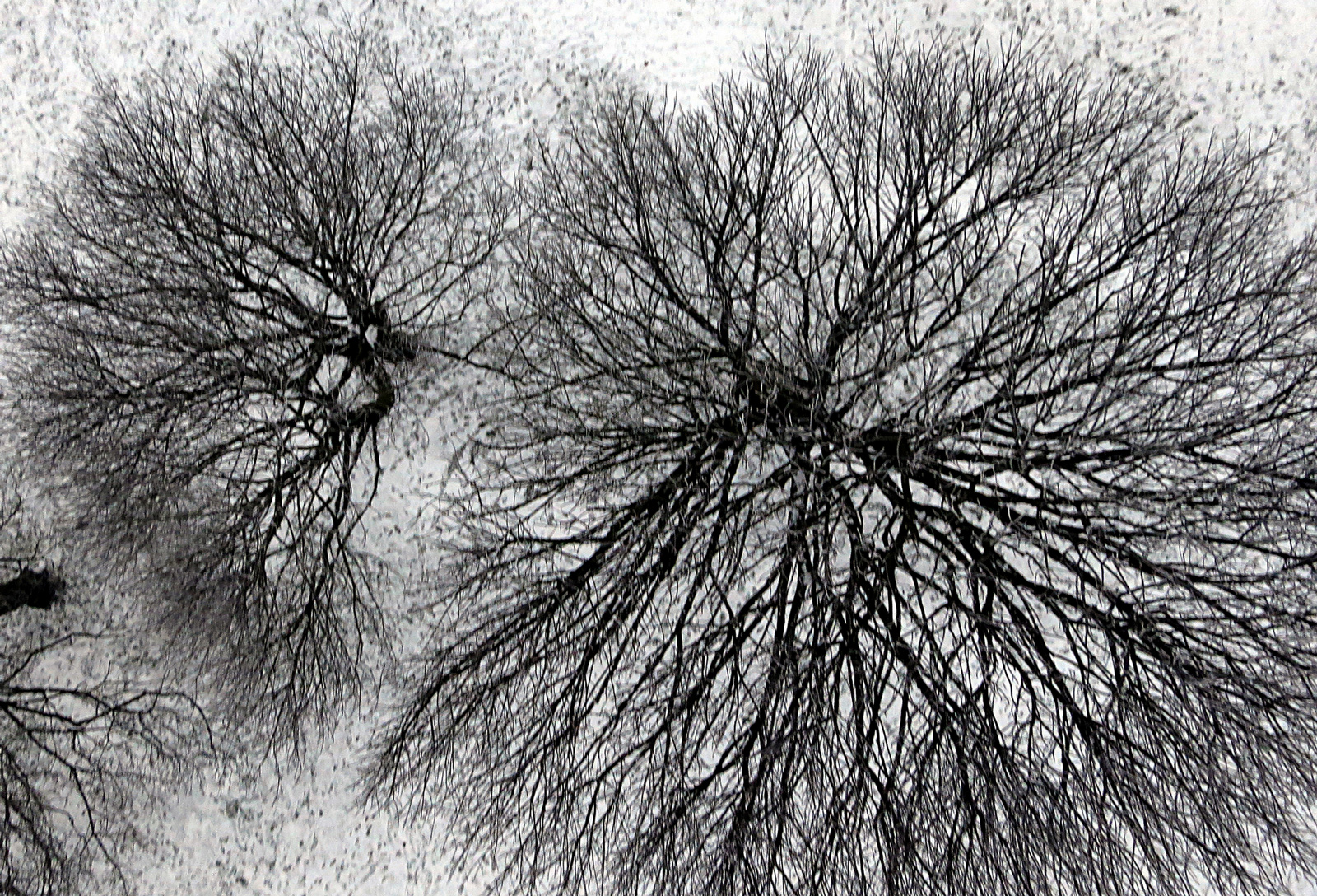

 Actually, it's a nesting Falcon. I do not pretend to know what this is all about, except that I understand the bird and almost certainly also the tree are Australian.
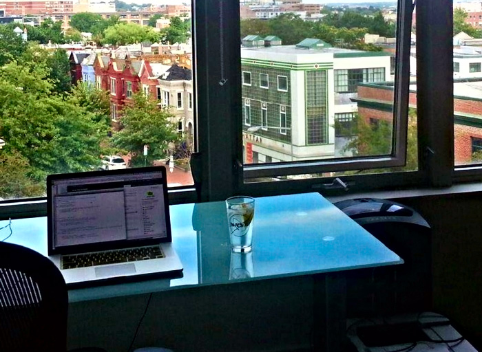 It's gotta be that shredder sitting by the windowsill, just to the right of the desktop.