Hole in the Clouds
Jun 7, 2010
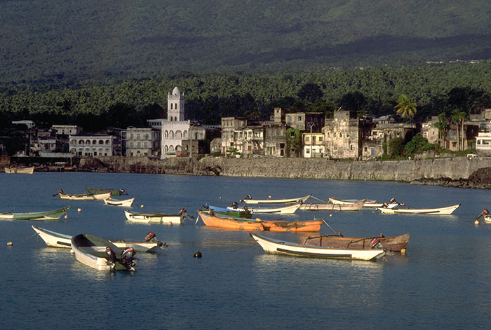
As the latest entry in an irregular series on places I've never been and know next to nothing about, consider this image of Moroni, capital of Comoros, an island nation in the Indian Ocean between Madagascar and Mozambique.
About 60,000 people live on the volcanic islands of the Comoro archipelago. Although the country is among the poorest on earth, armies have fought ferociously to control it, leading to twenty coups or attempted coups since the end of French colonial rule in the 1970s. Beginning in 2002, however, elections have produced governments that are said to be "more or less" stable.
Comoros is characterized by stunning volcanic scenery and spectacular, uncrowded beaches. But outside of Moroni there are no roads or tourist facilities. Government promotional literature recommends a visit only for visitors with "independent means."
landscape
cityscape
Indian Ocean
Moroni
Comoros
Africa
Jun 26, 2011
 Last week, baby Calla's visit back in Pennsylvania with the family included a little time on all fours out in the yard. A good time all around, according to Grandma. But on Friday, it was back to the airport for a long, long ride on a plane–back home to Zambia, in Africa.
Pennsylvania
Africa
Calla
Zambia
Dec 21, 2011
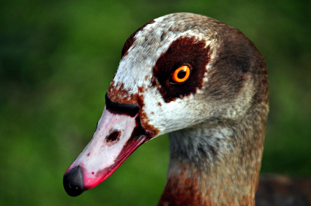
 This species of duck is native to Africa and is ubiquitous throughout the continent, except in deserts and deep forest. It is not native but nonetheless ubiquitous in many parts of Europe, especially England, where it was introduced more than three centuries ago and has thrived in town and countryside to such an extent that it was added last year to the official national list of animal pests. This picture was taken recently in London.
The birds are known as Egyptian Geese, despite the fact that they are ducks, not geese. Apparently, they have a heavy-looking habit of flight that makes them look goose-like in the air.
animal
duck
London
Africa
bird
goose
Oct 13, 2013
 Well, of course now that our American space program is shut down because of hateful people in the House of Representatives, the brand new Landsat 8 satellite that you and I paid for, which had just started phoning in dramatic new views of our planet, has gone dark. But fortunately, many other countries have legislatures that don't seem to go quite so insane over efforts to help people get medical care, and so new earth imagery from foreign satellites is still available to us.
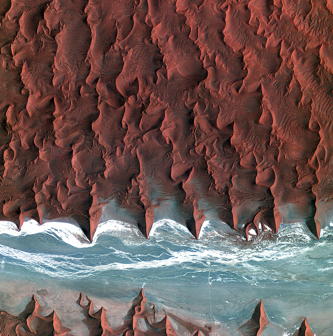
This is the view from Kompsat 2, a Korean satellite, as it crossed southern Africa above the Namib Desert on the morning of October 5. What appears to be blue water is actually an ancient riverbed, almost entirely dry for millions of years; the white streaks are bone-dry salt flats.
Click to zoom in and see roads in the riverbed and some black dots that represent the only vegetation for hundreds of square miles; These desert shrubs survive on groundwater, of which there is hardly any; such as is there is, however, collects deep underneath the riverbed, below the gullies where water does trickle on those rare occasions when it rains here. Annual precipitation is less than half an inch on average, though it is supplemented a bit by coastal fog.
Note the short spur leading off the main road near the middle of the scene and ending at the base of a dune. This is the route to a parking lot at Dune 45, a thousand-foot high sand dune popular with tourists.
birdseye view
Namibia
desert
space
remote sensing
Africa
satellite
Korea
(Image credit: Kompsat 2 via European Space Agency)