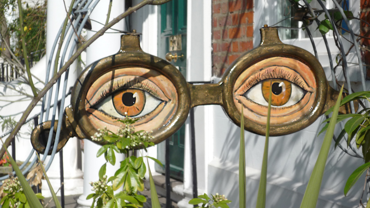
Your Tuesday Morning Infographic: Eyes
Sep 25, 2012
Sep 25, 2012
Sep 29, 2012
 Blatt Tire and Service, at the north edge of Chinatown in Philadelphia's Callowhill district, deals with cars at a location long devoted to trains. The sidewalk grating is labeled as an emergency exit for the subway, and the overgrown overpass in the background carries long-abandoned railroad tracks that have been designated for a makeover into an aerial park like New York City's new Highline.
The good news is: the car passed inspection.
Oct 5, 2012
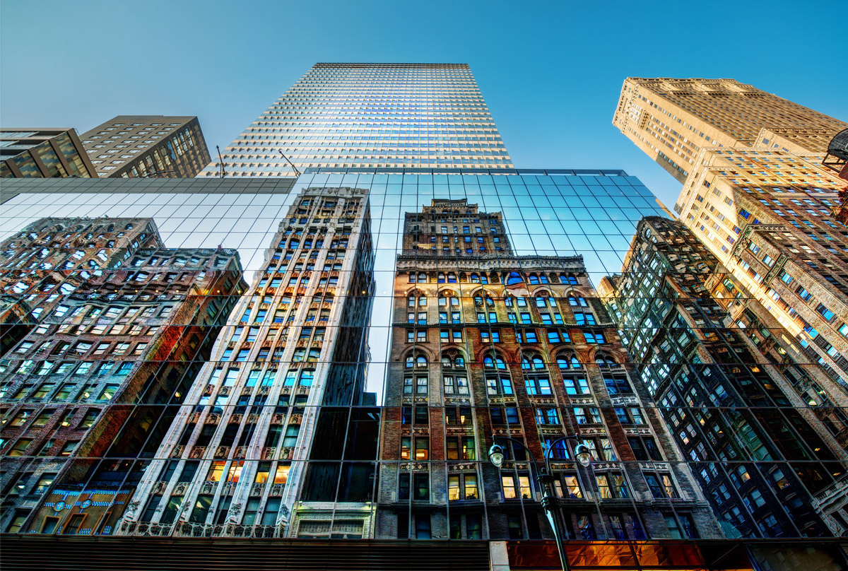 New York City (2012), by Trey Ratliffe.
Nov 2, 2012
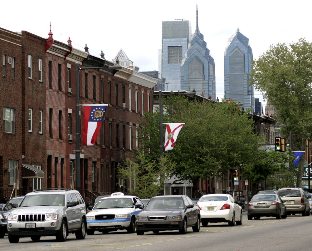 Odd thing about Broad Street in South Philadelphia: people park in the middle of the street.
Between the northbound and southbound lanes, there is pavement marked with diagonal yellow stripes, the kind of striping that, in all other parts of the world, says to drivers: "Keep your car out of this area." But on Broad Street, at least on the part of Broad Street that runs through South Philly, the empty space between lanes calls out, "Hey, right over here–park your car! Right here in the middle of the street."
Facing north, facing south, doesn't matter. Free parking is free parking.
Nov 9, 2012
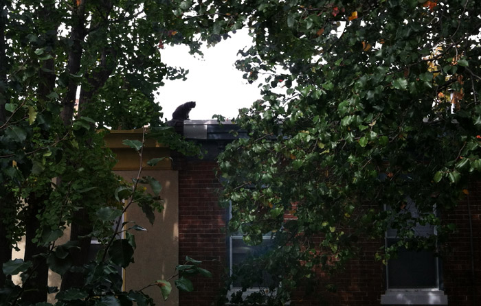 Looked out of my upstairs window a month or so ago, and there at the edge of the roof across the street was Samantha, a gargoyling sort of cat who'd followed her mistress up a ladder onto the roof and then, of course, refused to climb back down. Cats apparently missed the memo about going down ladders tail-first.
My neighbor eventually tossed Samantha down onto a second-story deck; she landed feet first and none the worse for wear–and by all accounts eager to get back up on the roof again.
Nov 12, 2012
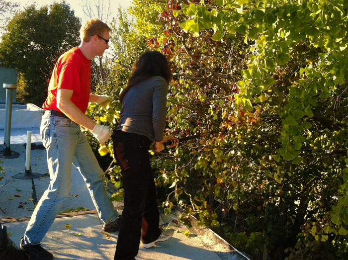 When you get a day in November that's t-shirt warm, it just seems right to get up on the roof. There were drainspouts to clear and trees to trim, debris to sweep up and . . . pictures to take.
Today's rooftop picture features our neighbors Carolyn and Frank; Carolyn works the pole trimmer while Frank hooks a finger in her beltloop to keep her safe.
Looking into the treetops, it became obvious that this year's fall weather has mostly been so mild that the leaves are only just now beginning to behave fallishly. But we trimmed the trees back so far that almost all the remaining leaves will eventually drop on the street or the sidewalk, not on top of the houses.
Nov 20, 2012
 Among the eighteen hundred photos submitted for this year's Philly Photo Day is this moment in time captured by Bonnie Saporetti, taken somewhere in Philadelphia, some time on October 26.
Nov 21, 2012
 He loves his dog, which we were told weighs 72 pounds. And he loves to ride his dog down the sidewalk on Rodman Street. You got a problem with that?
Dec 13, 2012
 During World War II, service flags like the ones hanging in these windows, could be seen in houses all over America. Within the red border of the window-hanging was sewn a blue star for each family member serving in the military. Gold stars acknowledged those killed in action.
The steps these children were playing on in 1942, along N Street SW in Washington, DC, were bulldozed a dozen or so years later as part of one of the country's largest "urban renewal" projects. All the residential and commercial neighborhoods in the city south of the national mall were condemned and all the residents evicted. The buildings were torn down and even much of the street grid scraped away, as a team of builders and designers led by I.M. Pei sought to start over from scratch, to create a 1950s-style urban utopia.
Before the urban renewal, Southwest Washington had been home to several generations of European immigrants and African American migrants from the South. Irish, Italian and Eastern European immigrants, possibly including these families, lived in the neighborhood west of Fourth Street SW, which was then known as Four and a Half Street. The street addresses here would have been very near Four and a Half Street. East of that street, mostly in more decrepit houses, lived African Americans, some of whom had come to Washington as freed slaves before or soon after the Civil War. The two adjacent neighborhoods both produced musical stars in the twentieth century: Marvin Gaye and Al Jolson.
Urban renewal wiped away all the homes, schools, stores, and other buildings except for one church, a fish wharf, and Bolling Air Force Base. A freeway was built through the middle of the new emptiness, with office complexes and new apartment buildings on either side. The project went the way of much mid-century city planning: people did come to work in the office buildings but went home every night as soon as they could, and people did live in the apartments but got in their cars and drove away to shop, play, and generally live their lives. Except at rush hour, neighborhood streets were empty.
It took another half-century, until 2003, before Southwest Washington got its first real grocery store. There has been something of a revival in recent years, as new stores opened and area parks were developed, giving people a reason to go outside and walk around. New apartment and condo projects have increased neighborhood density.
What happened to the thousands of people who were expelled from Southwest in the 1950s, possibly including the people in this picture? I'm not aware that anyone has kept track of them. Not to belittle their fate, but in one way or another, what happened to them happened to millions of Americans throughout the last century. In America, city people rarely stay put in the same neighborhoods generation after generation. People change and seek out different kinds of neighborhoods, and/or the neighborhoods change, pushing people out or leaving them uncomfortable and precariously clinging to homes in places that aren't what they used to be.
Dec 19, 2012
 Obviously worth a trip downtown, in Spokane, Washington.
Jan 11, 2013
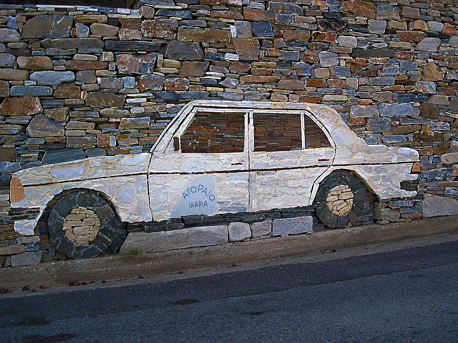 A taxi driver on the Greek island of Ikaria made himself a life-sized stone taxi on the wall outside his house.
Jan 31, 2013
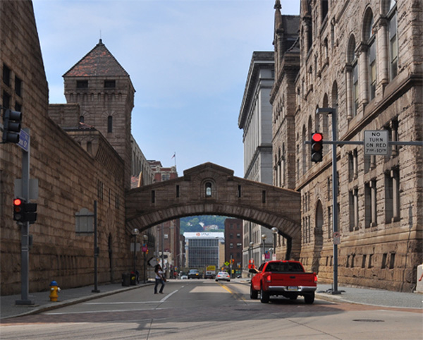
 This 1880s-era bridge connecting the Allegheny County courthouse with the jail in downtown Pittsburgh is a fair replica of the seventeenth-century Bridge of Sighs in Venice, which connected the prison with the interrogation chambers in the doge's palace.
In Pittsburgh as in Venice, prisoners being escorted across the bridge were said to catch a final glimpse of life on the outside before disappearing into the labyrinths of judicial inquistion and disposition. In both cities, too, the bridges and buildings survive to this day; the courthouse building at right in this picture is still an active courthouse, though the jail building at left now houses the county Family Services agency.
Modern-day photos, however, reveal an oddity: the bridge now appears to loom much higher above the street than it did back in 1903, when the picture above was taken. An urban-improvement project known as the Hump Cut, completed in 1913, flattened out major downtown streets in Pittsburgh, lowering Fifth Avenue here by several feet.
Feb 24, 2013
One thing we have in abundance in America is abandoned railroad tracks. Many thousands of miles have been torn up and paved over with asphalt, repurposed for walking and biking through cities and suburbs. Many of these rails-to-trails are pleasant amenities, but few are interesting to look at or exciting to experience. Today, we turn our eyes to a few of those few.
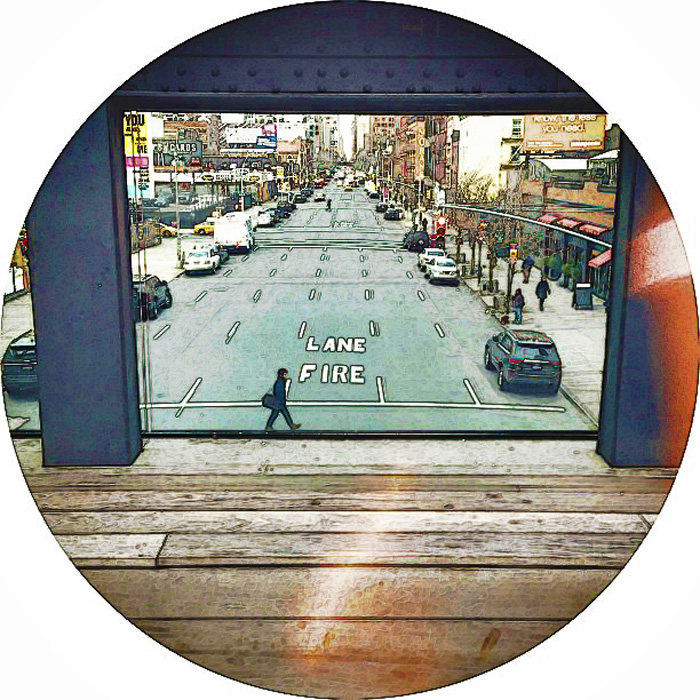
New York City's High Line Park, which we last visited back in 2011, is a garden in the sky, snatched from the ruins of an industrial el line that once carried cattle and chickens to the slaughterhouses of lower Manhattan's Hudson riverfront. Both the industrial roots and the post-industrial decline are celebrated in the park: everywhere, the grit and grunge, patched brick walls and rusted steel fixtures, are lovingly preserved, with landscaping that looks a lot like weeds and old-looking new (creosote-free) train tracks in the flower beds. Amongst the weeds are miles of boardwalk for strolling and people-watching.
This photo was taken from the High Line's amphitheater, a performance space cantilevered out over Tenth Avenue, with glass walls that keep the sounds of the city at bay. Down below, about a block away on the left side of the street, you can glimpse the edge of a parking lot that is also being reimagined as performance space, for a senior project by a Parsons School of Design student, our own Amelia Stein. All of us Hole-in-the-Cloudsians are eager to follow the progress of this work by one of our own.
Mar 1, 2013
 They've been getting a lot of snow this winter in Maine–a foot last weekend and a record 29.3 inches early in February from the storm they called Nemo, and more before and since and in between. This photo was taken after Nemo, in Portland's Old Port.
Some Mainers are probably happy about it.
Here in Philly, we got nothing.
Mar 9, 2013
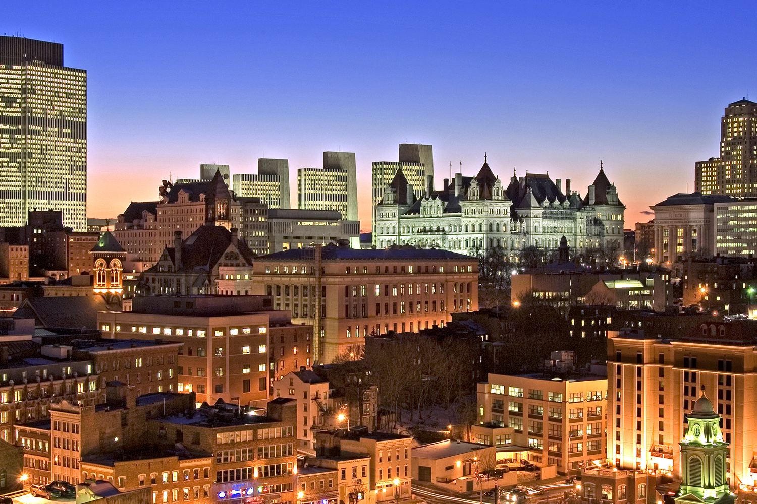 Nice looking skyline, is it not? The city is Albany, New York, which may or may not be a nice place to live or even a nice place to visit; I've never been there and yet . . . here I am squawking about it.
It's actually one of the oldest continuously inhabited cities in the Western Hemisphere, founded in the early seventeenth century as Beverwijk, a Dutch village outside the gates of Fort Orange. Beverwijk was renamed Albany when the English took over in the mid-century, and in 1686, the city was officially incorporated under a charter that is said to be one of America's oldest governing documents still in effect.
Albany was also the eastern terminus of the Erie Canal and for many years produced beer that was shipped westward on the canal to all the thirsty pioneers out in the hinterlands.
The painting below shows Albany's North Pearl Street in approximately 1800.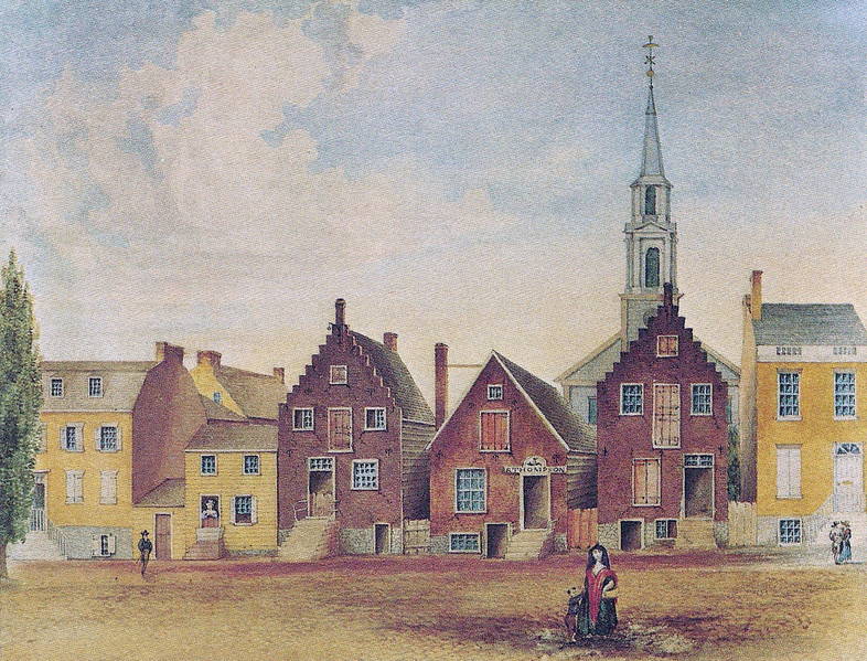
Mar 10, 2013
 Although George Chaconas advertised "fancy fruits and vegetables" at his grocery store in Washington, D.C., also prominent among his wares are chickens with their feathers and rabbits with their fur.
Way in the background is the Washington Monument. The store was in the area now swallowed up by the government office buildings of Federal Triangle.
By 1915, when this picture was taken, Chaconas had been in the grocery business for more than a quarter century. In addition to the store, which had been in this location for about a decade, he and his family also sold groceries from a truck–the kind of vehicle referred to then as a huckster wagon–that made the rounds of the outlying neighborhoods.
Back in the 1890s, however, when he was first establishing himself in Washington, Chaconas sold his fruits and vegetables from a pushcart. On August 14, 1894, as recorded by the Washington Post, Chaconas and eleven other Greeks and Italians were arrested and fined for lingering too long and obstructing traffic with their pushcarts.
Apr 8, 2013
 Pace, Mother Maybelle.
Apr 29, 2013
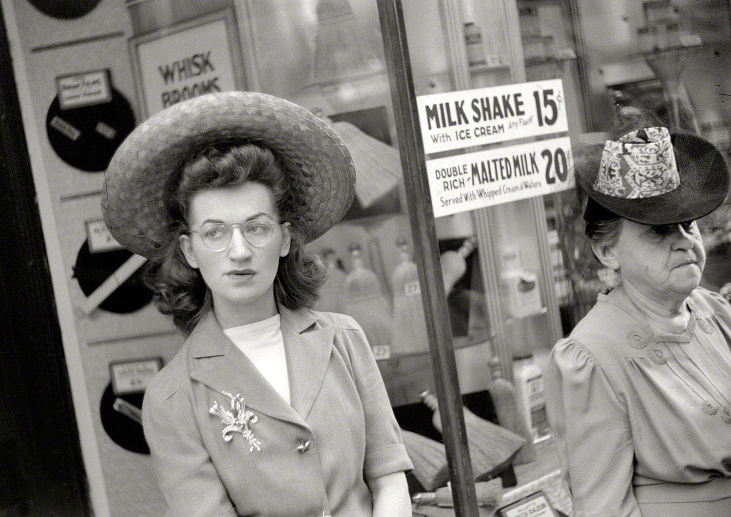 Two women wait for the streetcar in front of a Chicago store window in the summer of 1941.
Jun 22, 2013
 Hats trimmed free of charge, according to the bronze lettering above the 8th Street entrance to the old Lit Brothers Department Store in Philadelphia. The original Lits opened here in 1891 and expanded to about a dozen locations in southeast Pennsylvania and south Jersey before the national chains killed it off in the 1970s. Today, Ross Dress for Less occupies part of the first floor.
Jun 25, 2013
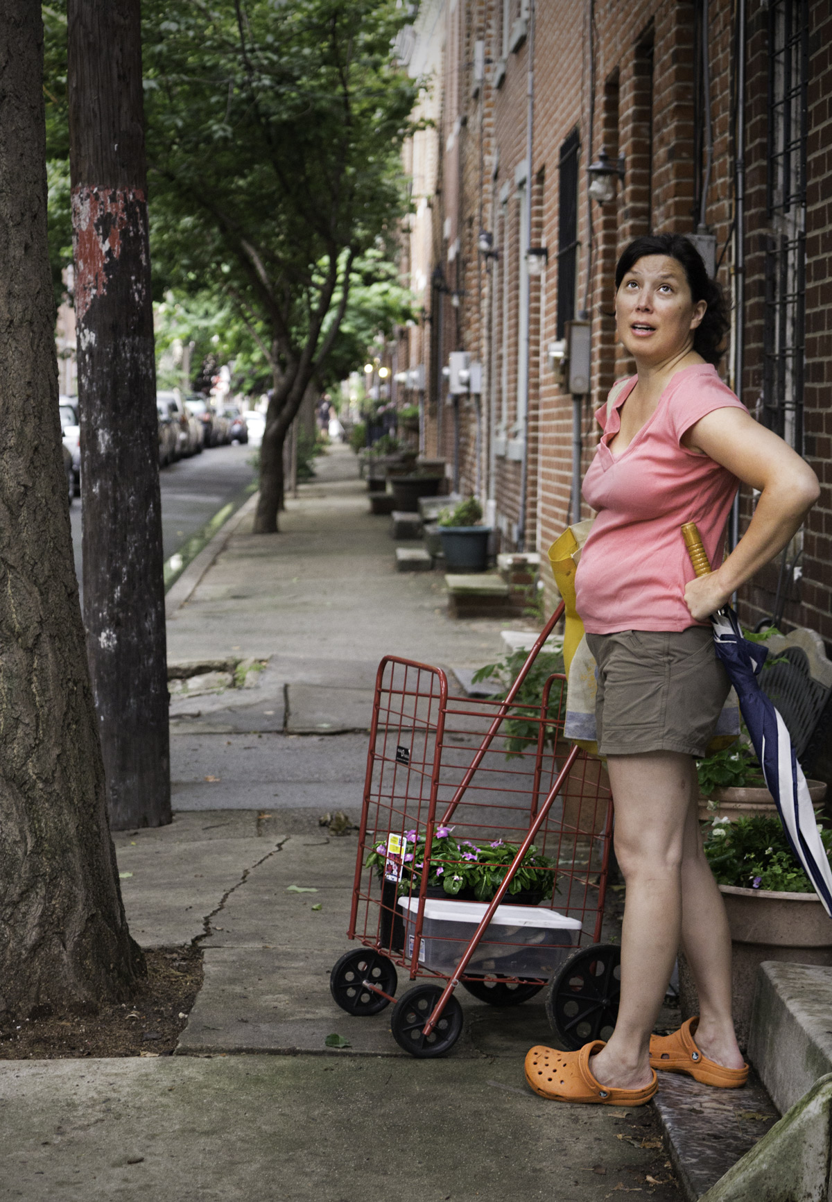 Expecting more rain on Kater Street
Jun 28, 2013
 In the City of Brotherly Whatever, this truck shows up every weekday at 33rd and Arch streets, offering such bean blends as Palooka, Revolver, and Whistle & Cuss.
Jul 4, 2013
 It's not hard to remember the excitement of those days fifty or so years ago when the teacher would tell us to pick up our chairs and form a line at the classroom door. We would all carry our chairs down the hall from the classroom to the school's "all-purpose room," where we could sit facing a big black-and-white TV set at the front of the room to watch those guys at NASA choreograph a countdown and a liftoff and all the other amazements that were part of America's new space program.
Today, it's hard to figure out exactly what NASA is up to in outer space. There seem to still be astronauts, but it appears that we now rely on the Russians to do that whole countdown-liftoff thing. Americans mostly look at pictures from faraway cameras.
From Ted in Washington, D.C., comes this photo of a sign of the times for NASA and perhaps the grand American dream: a NASA message held in place by a bicycle chain and a couple of sacks of Quikrete. The NASA folks may not be zipping around in space these days as much as they used to, but their public website is freshly launched, or rather relaunched on a freshened, open-source, space-age sort of platform, saving us taxpayers millions in licensing and maintenance costs. For this, we can thank our Ted and his Inner File, the little company that could.
Do people still have hot dogs and watermelon for the Fourth? Hope so.
Jul 10, 2013
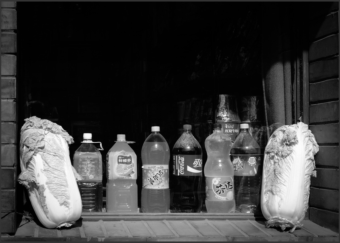
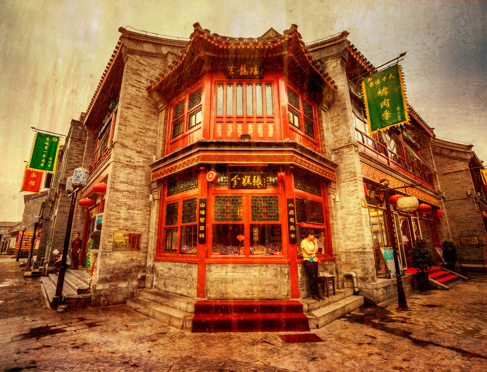 Corner store in Beijing, China.
Jul 17, 2013
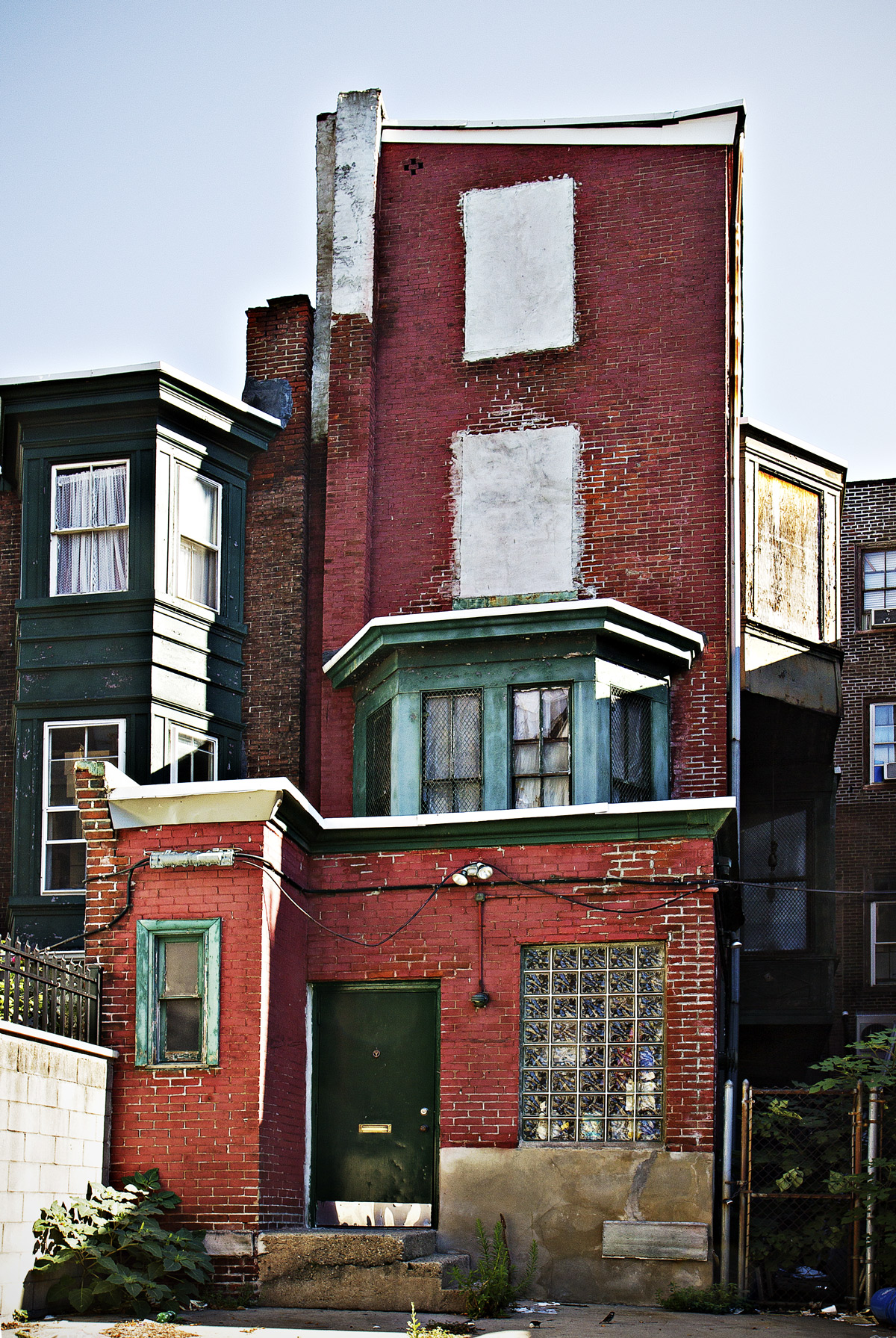 House on Cypress Street near Broad in downtown Philly.
Jul 18, 2013
 This week in Brooklyn. Could be Philly.
Jul 26, 2013
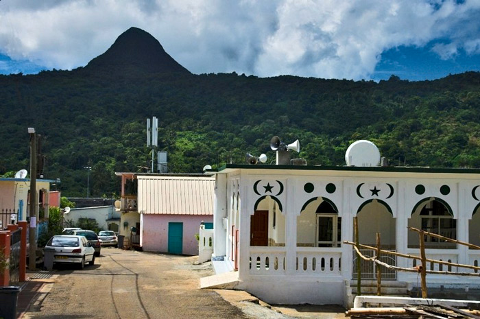 On New Year's Day of 2014, the islands of Mayotte, population 194,000, in the Indian Ocean channel between Madagascar and Mozambique, will become the newest official Outlying Region of the European Union. Already, the currency here is the euro.
Most islands in the archipelago that includes Mayotte are part of the independent Union of Comoros. But in 2009, the voters of Mayotte chose overwhelmingly to affiliate with France, as its 101st département, instead of with Comoros. French citizens need no visas to vacation in Mayotte, and many of them do just that, notably for the diving in the island's lagoon and coral reef.
Tourism seems to be the major industry; per capita GDP in Mayotte is about $6,500–ten times that of Comoros, though only about one-fifth that of mainland France.
Most of the population is Muslim. Seen here is the mosque in the town of Kani Kéli.
Jul 27, 2013
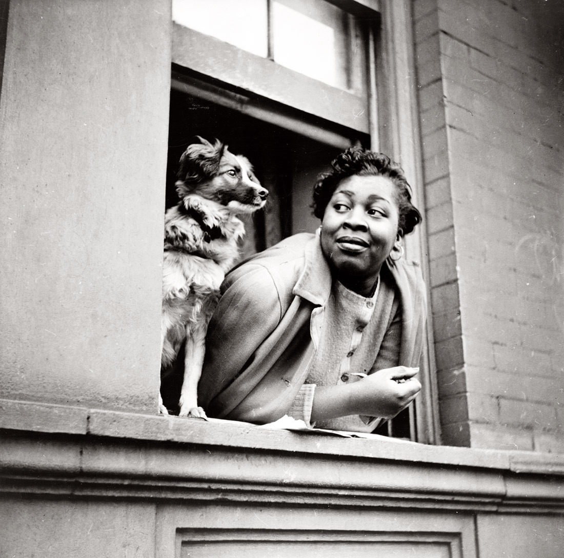 A woman and her dog, by Gordon Parks. New York, May 1943.
Jul 29, 2013

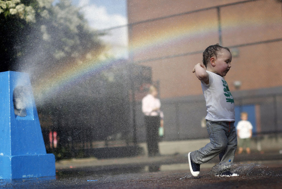
As leafy as the trees may be, when the summer sun takes aim at bricks and concrete, the light will find a way.
Aug 3, 2013
 But what's that car doing on the boardwalk?
Sep 5, 2013

Sep 6, 2013
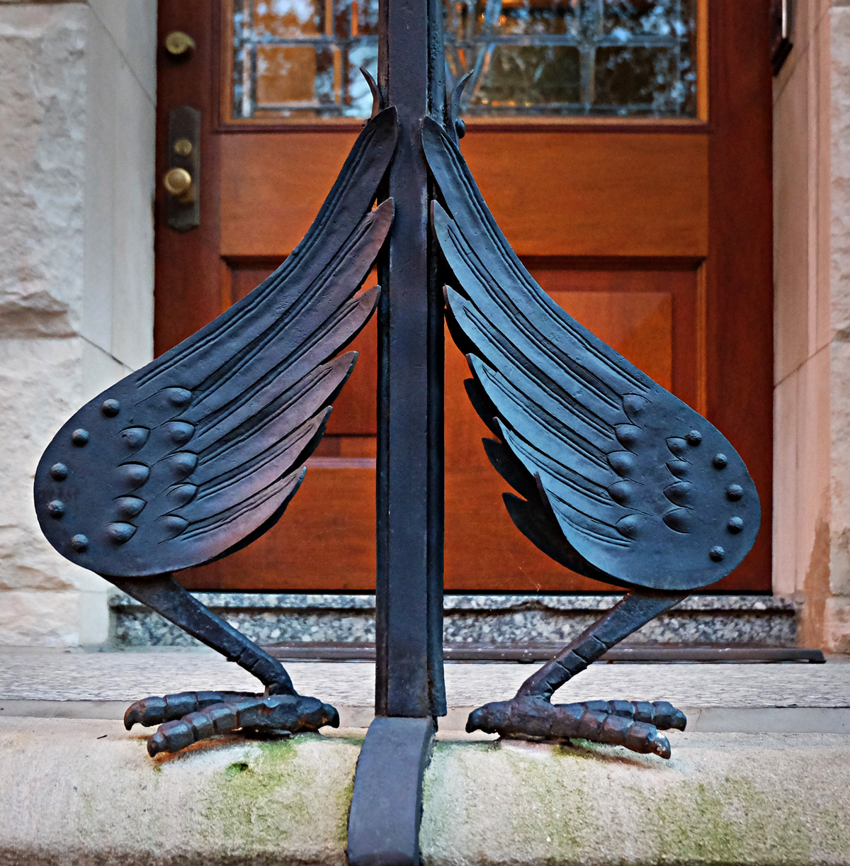 The railing on the stoop in front of this Rittenhouse Square dentist's office is held up by wrought iron wings and drumsticks.
Sep 10, 2013
 The caged bird sings. Above a doorway in the old quarter of Lisbon.
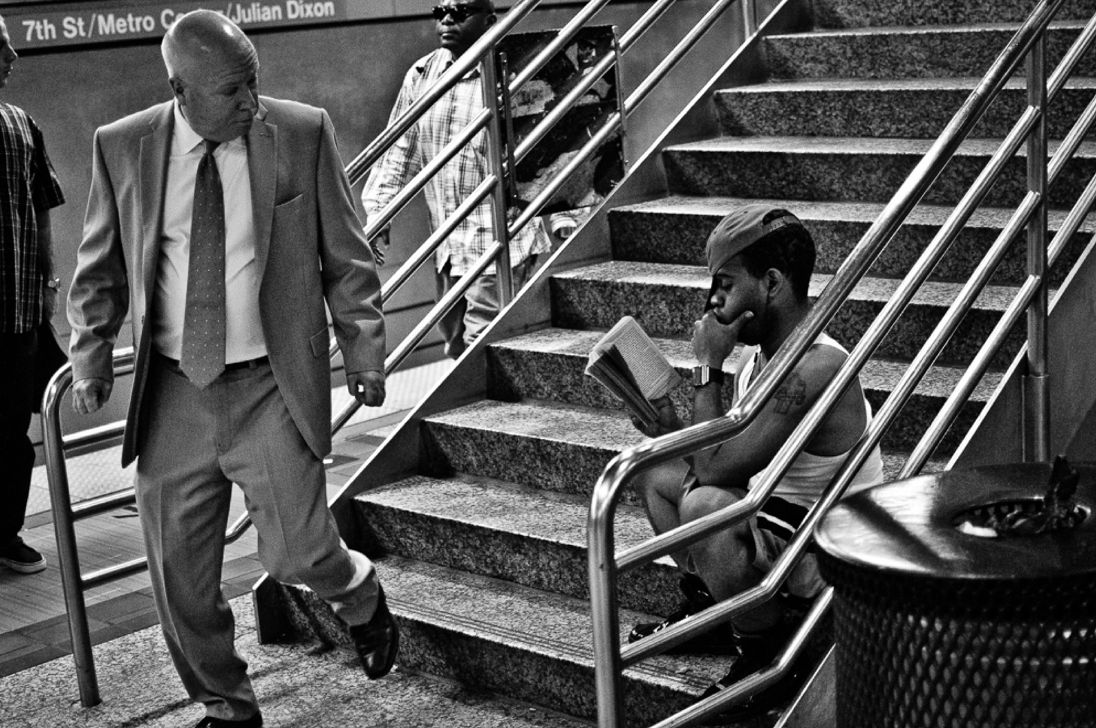
Sep 21, 2013
Sep 15, 2013
 We have nothing to say.
Sep 16, 2013
 In downtown Los Angeles.
Oct 5, 2013
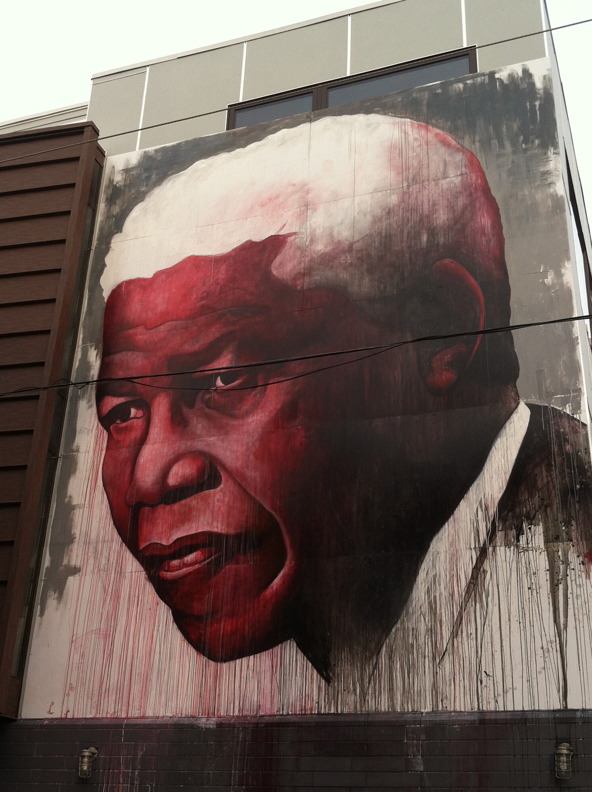 There's a new mural in the neighborhood, bolted high on the wall of a new house at the corner of Fitzwater and Smedley. Looks to be a private project, not part of the city's Mural Arts Program, and it's hard to say if it's intended as permanent street art, since it mostly blocks the windows of the house. But it's something to look at, a portrait of Nelson Mandela looming above a scrim of drippy red and black streaks. The painter signed the mural illegibly; we believe that whoever he or she is, he or she got it right, those dark, worldly, heavy-lidded eyes in a brilliant red face.
Oct 7, 2013
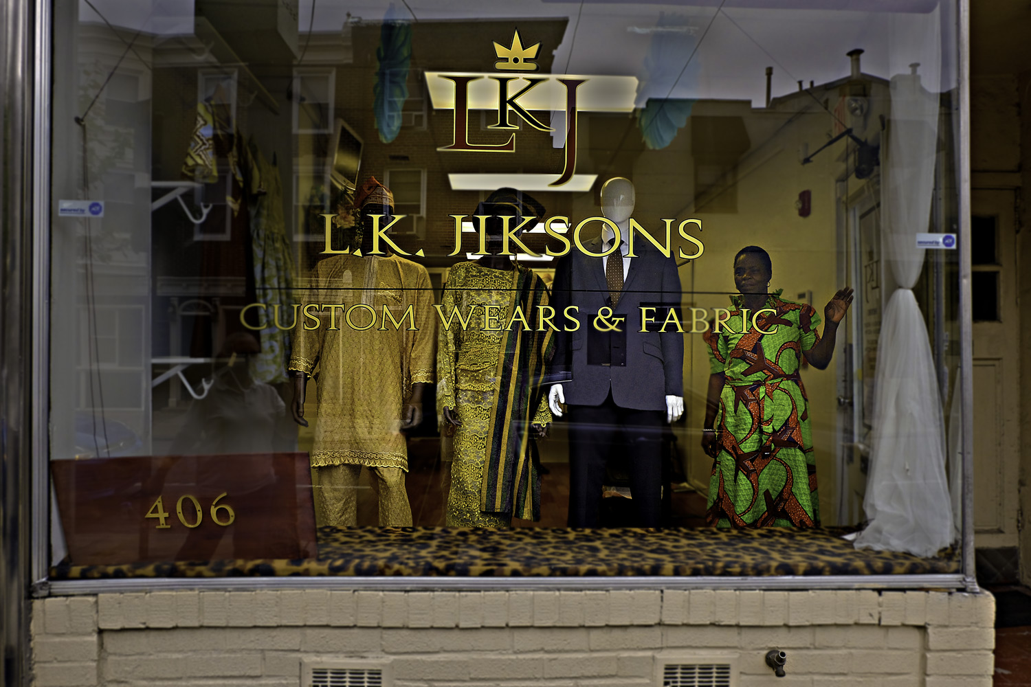 In the shop window of L.K. Jikson's on South 20th Street, a few blocks from Rittenhouse Square, stands a woman wearing a dress made of fabric printed in chartreuse, orange, and maroon. Click on the picture to see an enlarged view: the maroon shapes in the print are actually jet airliners.
Oct 14, 2013

 Every Sunday afternoon on the Race Street Pier, there is of course a hula hooping dance class.
Oct 23, 2013
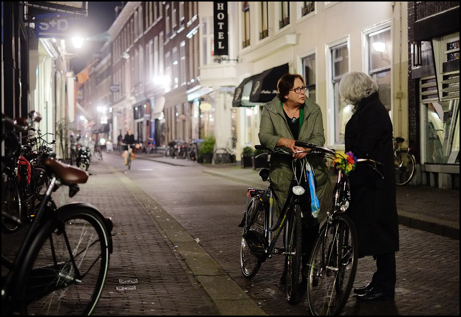 On the street in den Haag, Holland.
Nov 12, 2013
 The highlight of this year's Australian Spring Racing Carnival, if it wasn't these hats, was last week's 153rd running of the Melbourne Cup, "the race that stops a nation."
Winning horse was Fiorente, trained by actress Gai Waterhouse. The BBC points out that even though Waterhouse spent several years in Britain, she is definitely Australian and thus continues the unbroken streak of 153 consecutive Melbourne Cup winners trained by non-British trainers.
Nov 13, 2013
Nov 22, 2013
 Since it's November 22, our picture today is from Dallas, Texas. But so far as we know–and we believe we know far enough–it shows us nothing that adds anything whatsoever to our understanding of what happened in Dallas back then. It's just kind of a nice wall.
Nov 23, 2013
 They're gutting yet another house in the neighborhood.
Nov 24, 2013

Thanks to the work of this volunteer and many hundreds of others, Philadelphia got 850 new street trees on Saturday, bringing the overall regional total of trees planted to–according to the calculations of somebody or other, as of Saturday night–exactly 262,236.
The goal is a million new trees, in hopes of restoring the forest canopy area heareabouts to 30%, which would provide enough shade to significantly mitigate the urban heat-island effect and would improve air and water quality, reduce erosion and water pollution, and lessen the frequency and severity of flooding.
The tree roots at bottom right in this photo belong to a variety of maple tree that is particularly hardy in urban settings and has a growth habit suitable for its new home in the urban jungle on South 21st Street, in front of a dentist's office and across the street from a dry cleaner's.
Jan 8, 2014
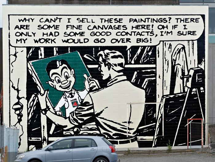 The little guy here in the white apron, with a pencil behind his ear–that's Mr. 4, the grocer-mascot of New Zealand's ubiquitous Four Square chain of supermarkets.
The mural featuring Mr. 4 covers a side wall of the art museum in Christchurch. The museum is closed at the moment and has been for a couple of years. All the artwork currently on exhibit is out in the streets of the city, like this piece.
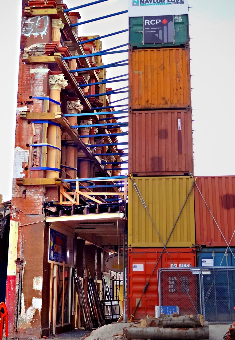
Perhaps you are wondering why in the picture below there's a crane on top of the museum? Hold that thought; we'll get to it soon.
Jan 11, 2014
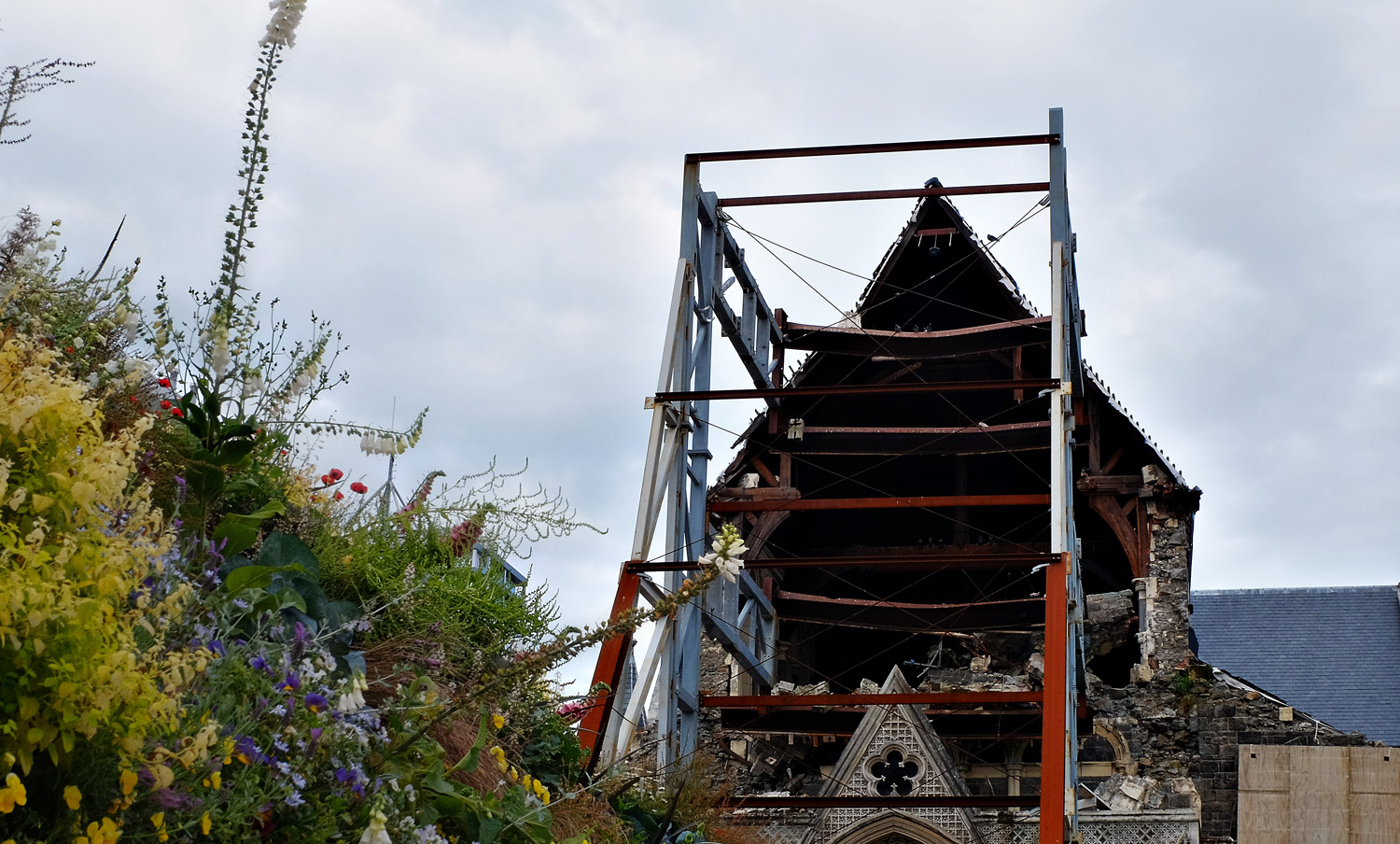
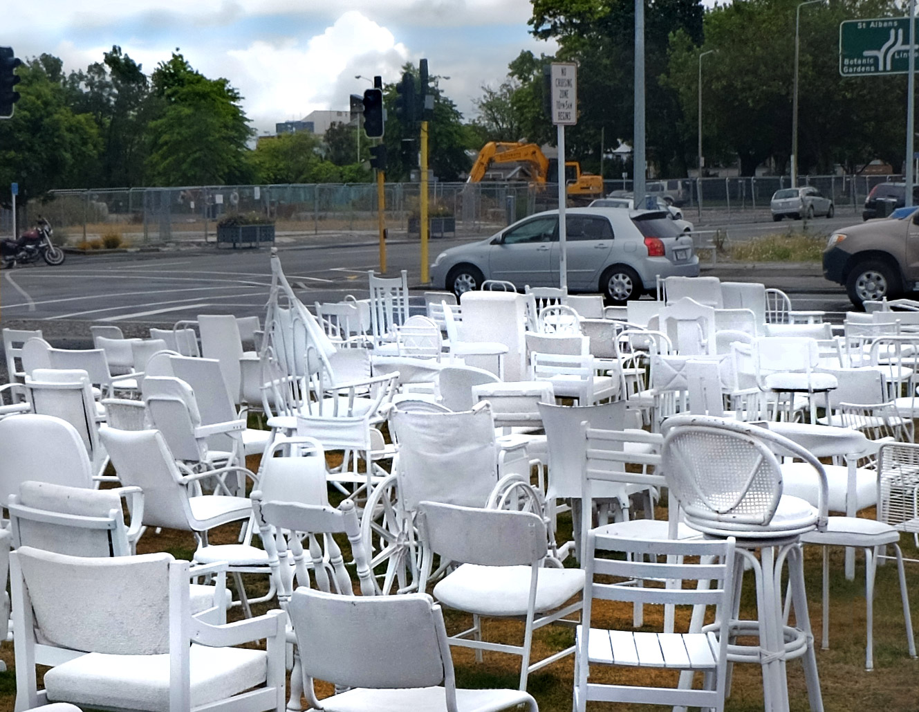 On 22 February 2012, white-painted chairs were set up alongside busy Cashel Street in Christchurch, New Zealand, each one different from the others, all of them empty. They covered a freshly sodded swath of a freshly vacant lot, where Baptists used to go to church before an 18-second-long earthquake took out the church, along with about 8,000 other buildings in town.
The chairs memorialize the 185 residents of Christchurch who died in the quake. One hundred fifteen of them were in a six-story office building that day across the street from what is now the memorial; in 18 seconds, the building pancaked and caught fire.
The chairs appeared one year to the day after the quake. Like so much else in the city's recovery from the disaster, the chair memorial, designed by Peter Majendie, was planned as transitional and very temporary, to remain on display for a week.
It's still there. Believe it or not, vandals steal chairs from the memorial every now and then, but so far at least, they've been replaced.
This transition stuff can be tough. New Zealand's latest census figures came out last month, revealing that more than 40,000 people have left Christchurch since the earthquake. The city is no longer the country's second largest. The official estimate now is that recovery will take twenty years, minimum.
Here is how people in Christchurch described the quake to us: the earth heaved straight upward, we were told, and then plummeted, slamming back down. Eyewitnesses reported seeing people literally thrown up into the air.
The next several posts will look at what's going on there nowadays, a little less than three years later.
Jan 14, 2014
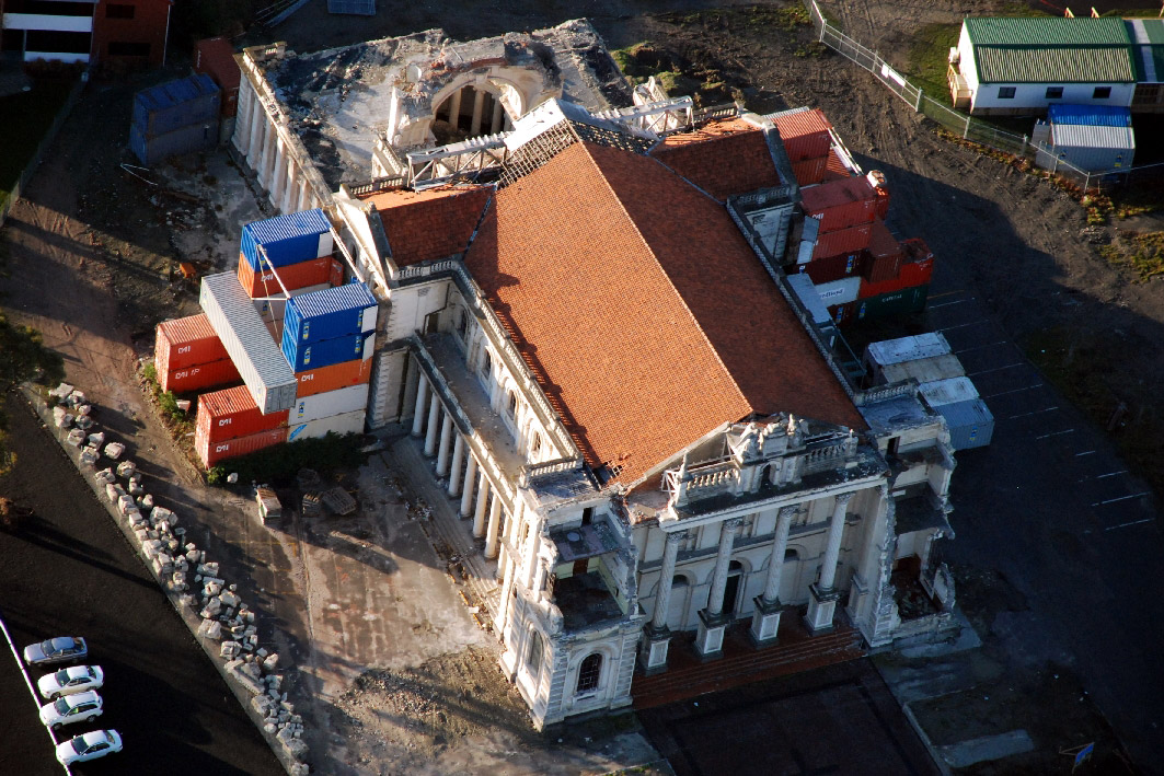

Jan 16, 2014
 Public restroom on Queen's Wharf in Wellington, New Zealand.
Jan 23, 2014
Feb 17, 2014
 Marco's rock is right on track for the U.S. of A.