African beach
Oct 3, 2009
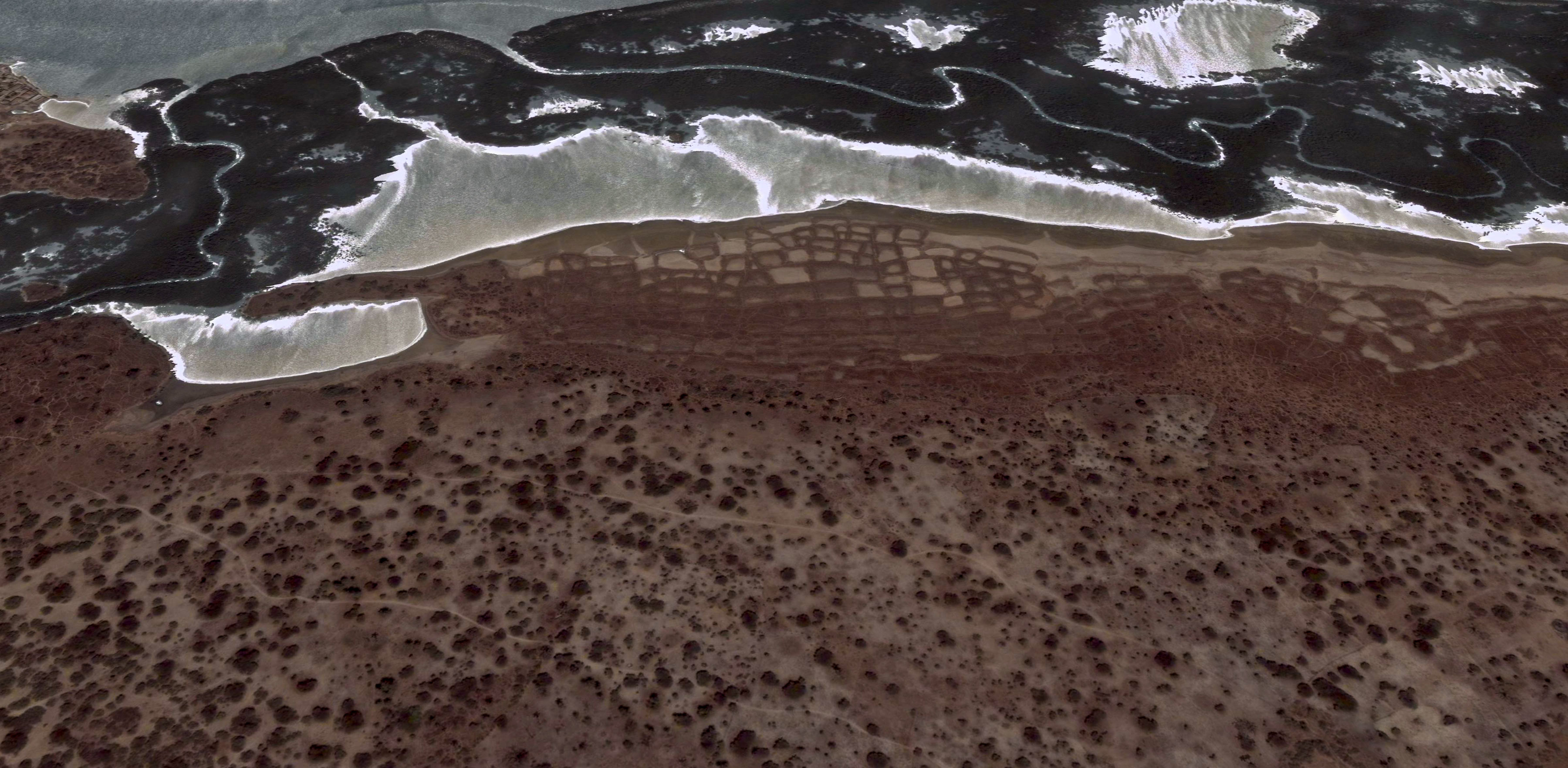
The Atlantic coast of Senegal near the mouth of the Gambia River, as perceived by the sensors of the Landsat 7 satellite.
Oct 3, 2009
The Atlantic coast of Senegal near the mouth of the Gambia River, as perceived by the sensors of the Landsat 7 satellite.
Nov 17, 2009

West Virginia, from outer space.
Feb 1, 2010
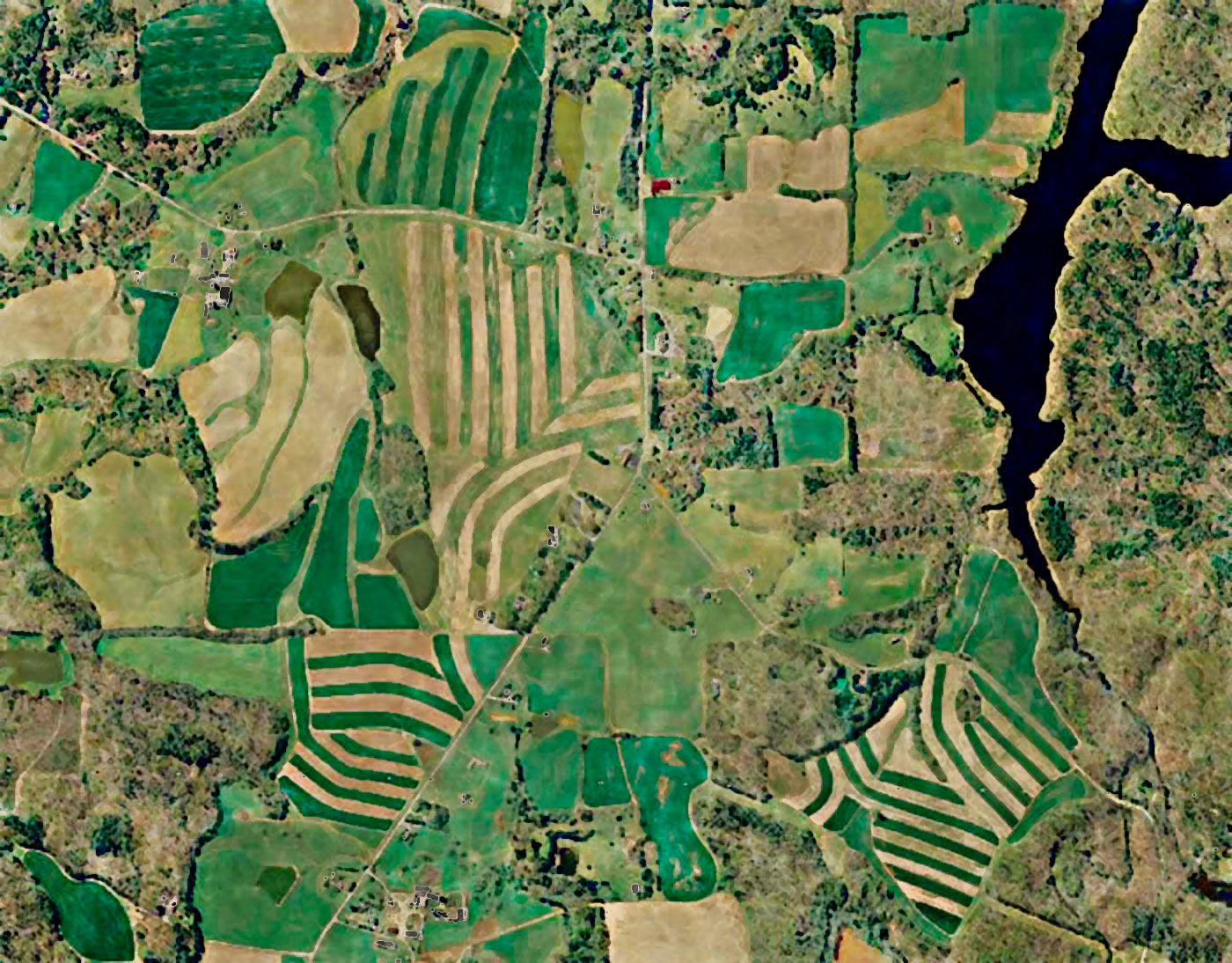
Every summer, the U.S. Department of Agriculture contracts with pilots around the country to fly over every square inch of American farmland taking pictures. They use the imagery to figure out how well crops are growing, and exactly how much land is being used for various kinds of crops. But more importantly, they turn the imagery over to state government GIS departments, which have come up with thousands of uses for seamlessly mosaicked pictures of almost all the land in the United States.
The pictures show roads and cities and lakes and rivers, of course, as well as farm fields, so they make good base data for maps. They show changes in the landscape--e.g., new subdivisions and drained wetlands. Infrared bands in the imagery can show all sorts of details, including how much sediment there is in a river and how quickly a forest is coming back after a fire.
This picture started out as hazy USDA imagery from Orange County, North Carolina. I turned it upside down--south is now at the top--to make the shadows look "normal"--flip it back 180 degrees and see for yourself how strange it looks; the wooded areas, with all their shadows, look like sunken green and brown depressions amid smooth, raised crop fields. That's because our eyes have been "trained" by centuries of hand-shaded maps to expect the source of "light" to be in the upper-left corner, even though in real life the sun is never in the northwest quadrant of the sky (except down under, in the southern hemisphere). This is one of many reasons why satellite and aerial images, while fascinating to look at and extremely helpful in mapmaking, do not themselves make attractive backgrounds for maps. Unless we can accustom ourselves to putting south at the top.....
Feb 2, 2010
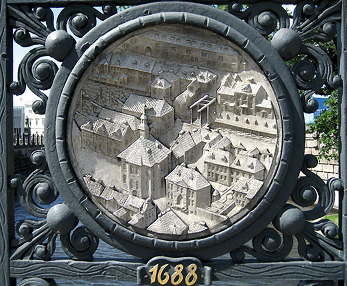
I know nothing about this picture, except that it was taken in Berlin. I like the little city in the circle there, but then I would. The gate is nice, too.
Jun 24, 2010
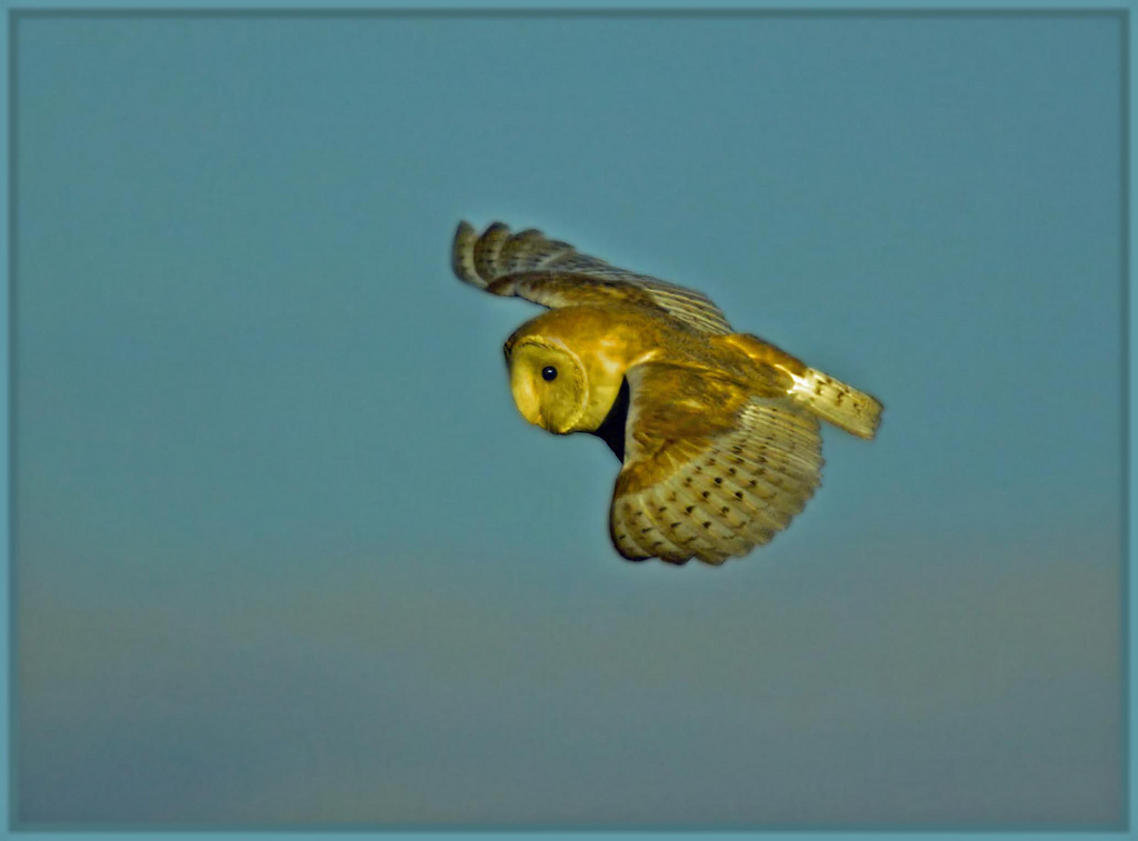
This barn owl was out hunting in the low light of a long summer evening, in Warwickshire, England.
Nov 13, 2011
 A couple of weeks ago, on Philly Photo Day, Ashley Cabrera shot this scene of a train headed eastward above Market Street in West Philly. Some of the Love Letter rooftop murals can be glimpsed off to the right, and of course that's the Center City skyline straight ahead.