Lena's Mouth
Dec 9, 2011
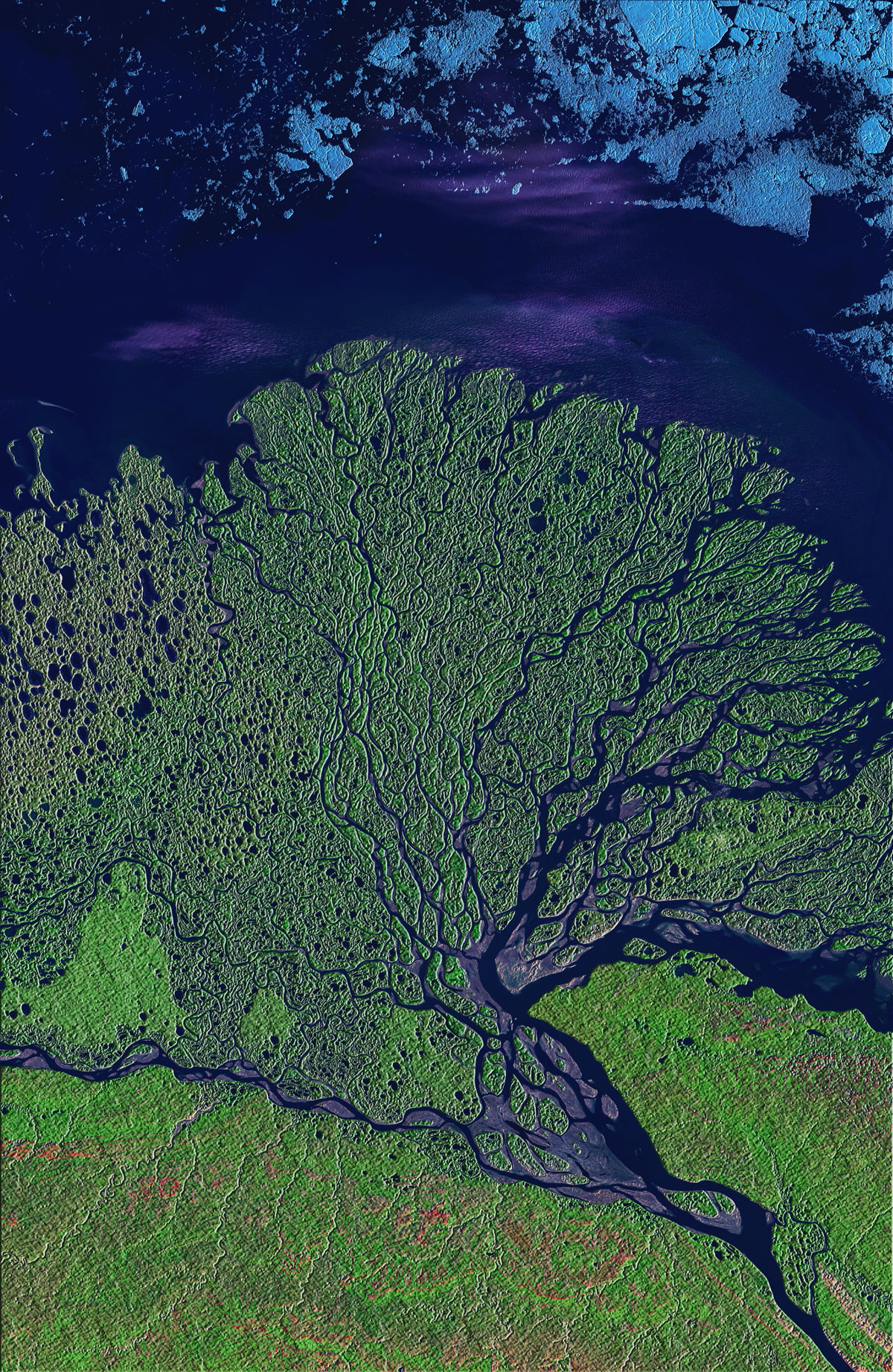
The satellite view of Philadelphia in infrared, from a few days ago, led some people to ask for more false-color imagery of our planet. Here we've got a river delta in the tundra of eastern Siberia, where the River Lena empties into the Arctic Ocean. The image is from mid-summer, when the plants of the tundra were bursting with new growth, thanks to twenty-four hours a day of sunlight. The color scheme here is different from that of the Philadelphia scene but still not closely related to the colors a human eye would detect. The data displayed comes from three sensors on the Landsat satellite: one that detects infrared energy, another that detects near-infrared energy, which is very sensitive to the chemicals associated with growing vegetation, and a third sensor that picks up a part of the visible spectrum. Vegetation is green, exposed rock or soil is pink, wet soil (mud) is purple, and ice is blue.
Even in mid-summer, the sea ice floats close to shore. It will take another month or two for most of the ice to melt and/or wash out to sea, but as soon as it does freezing temperatures will return and ice formation will begin again.
The innumerable ponds and distributary streams are typical of flat places throughout the Arctic tundra, where permafrost just below the surface impairs drainage. Meltwater and rainwater sit on top of the permafrost all summer long, breeding mosquitoes...... which don't show up in the satellite imagery.