Hole in the Clouds
Sep 3, 2011
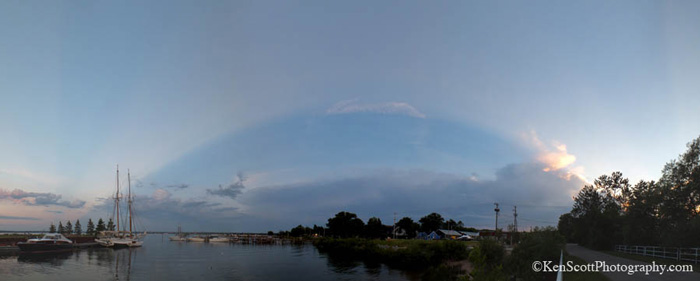 On June 30, 2011, rhe cloud at the righthand side of the sky in this picture cast a big shadow over the West Arm of Grand Traverse Bay, near Traverse City, Michigan. That's because the sun had already set, and its last rays were hitting the cloud from a very low angle, well below the horizon.
The top of the shadow looks curved, I'm told, because of the extremely wide angle of vision here. It's a perspective thing–we think of the horizon line off in the distance as a straight line, but in a wide-angled scene like this we can see that it's actually a curved arc. For a few minutes, the shadow darkens a wedge of the celestial sphere; then this part of the world turns away and the scene is in serious earth shadow, not just cloud shadow, till morning.
landscape
sunset
Michigan
Grand Traverse Bay
cloud
Traverse City
shadow
(Image credit: Ken Scott)
Jun 11, 2014
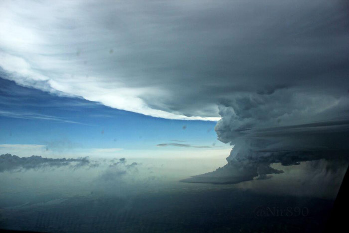
 On Monday, the skies over Paris got themselves all tied up in a knot and spit out baseball-to-softball-sized hail across the Ile de France.
The supercell wall cloud at the heart of the thunderstorm is shown in this photo snapped by a commercial airline pilot whose jet passed safely by, if a little too close for comfort. The cloud grew so tall it bumped up against the tropopause–essentially, the upper boundary of the atmosphere–where it spread out flat.
This sort of weather is a common summertime phenomenon across the Great Plains in the United States, but it's rare in most other parts of the world. For the past three days, however, France has been enjoying supercell storms in all their magnificence.

sky
France
cloud
storm
supercell
(Image credit: @Nir890)
 On June 30, 2011, rhe cloud at the righthand side of the sky in this picture cast a big shadow over the West Arm of Grand Traverse Bay, near Traverse City, Michigan. That's because the sun had already set, and its last rays were hitting the cloud from a very low angle, well below the horizon.